Showing posts with label urban design. Show all posts

Tuesday, December 09, 2025

RIP Frank Gehry

Another iconic architect has gone the way of all flesh:

Frank Gehry, who designed some of the most imaginative buildings ever constructed and achieved a level of worldwide acclaim seldom afforded any architect, has died. He was 96.

Gehry died Friday in his home in Santa Monica after a brief respiratory illness, said Meaghan Lloyd, chief of staff at Gehry Partners LLP.

Gehry’s fascination with modern pop art led to the creation of distinctive, striking buildings. Among his many masterpieces are the Guggenheim Museum in Bilbao, Spain; The Walt Disney Concert Hall in Los Angeles and Berlin’s DZ Bank Building.

He also designed an expansion of Facebook’s Northern California headquarters at the insistence of the company’s CEO, Mark Zuckerberg.

Gehry was awarded every major prize architecture has to offer, including the field’s top honor, the Pritzker Prize, for what has been described as “refreshingly original and totally American” work.

Other honors include the Royal Institute of British Architects gold medal, the Americans for the Arts lifetime achievement award, and his native country’s highest honor, the Companion of the Order of Canada.

Gehry, who took advantage of new technologies and building materials to design seemingly heretofore-impossible forms, was already a star within the architectural world before designs such as the Bilbao Guggenheim made him notable to the broader public. As a student at the University of Houston College of Architecture in the early 1990s, I studied his earlier works extensively. One year for the college Halloween party we held a "Very Scary Frank Gehry Pumpkin Carving Contest," whereby students submitted pumpkins carved in all manner of unconventional and deconstructionist designs that mimicked his style. 

His vision did have its share of detractors, however: 

Not everyone was a fan of Gehry’s work. Some naysayers dismissed it as not much more than gigantic, lopsided reincarnations of the little scrap-wood cities he said he spent hours building when he was growing up in the mining town of Timmins, Ontario.

Princeton art critic Hal Foster dismissed many of his later efforts as “oppressive,” arguing they were designed primarily to be tourist attractions. Some denounced the Disney Hall as looking like a collection of cardboard boxes that had been left out in the rain.

Still other critics included Dwight D. Eisenhower’s family, who objected to Gehry’s bold proposal for a memorial to honor the nation’s 34th president. Although the family said it wanted a simple memorial and not the one Gehry had proposed, with its multiple statues and billowing metal tapestries depicting Eisenhower’s life, the architect declined to change his design significantly. 

You don't get to be one of the world's most famous architects by being unprovocative, and to be sure, even I thought that some of his designs were more successful than others. Gehry described architecture as being inherently sculptural; his buildings, with their kaleidoscopic materials and complex geometries, reflect that philosophy, for better or for worse. They will remain here for us to enjoy, even though he himself is now gone.

Time's Belinda Luscombe explores the charming mischievousness of Gehry's work, while The Atlantic's Carolina Miranda argues that Gehry's best works were not his flashiest.

Wednesday, October 09, 2024

You can choose two out of three

A great diagram:

Granted, "successful city" means different things to different people; to me, that means a metropolitan area that is economically vital and a place where people want to live, work and play. 

That means that there are going to be a lot of people traveling around said city, and there are trade-offs when it comes to how people want to travel around. If the private automobile is the preferred method of travel (as it is in most US cities), then there is going to be congestion. 

We can't "build our way out if it;" it just doesn't work that way.

Trust me; I've been in the transportation planning profession for a quarter-century.

Tuesday, October 03, 2023

Imagining a Manhattan-like Galveston

I came across this post on The Social Media Platform Former Known as Twitter last week, and it suggests an interesting thought experiment: 

Galveston was the largest city in Texas prior to the Great Hurricane of 1900. What if that storm had had never hit Galveston, and the city continued to grow? What if the Galveston Seawall was a proactive, rather than reactive, project to harden the island against natural disasters? Would the region's urban geography look completely different? Would Galveston have eventually developed into a dense, Manhattan-like urban core from which everything radiated out, leaving Houston as little more than a suburb on the northwestern edge of a hypothetical Greater Galveston Urbanized Area?

Of course, as Christof's response indicates, there were factors working against Galveston that favored Houston, even before the 1900 hurricane hit. Transportation truly is destiny, and it did not favor Galveston Island.

Also, in the real (not "what if") world, the Hurricane of 1900 (and its almost-as-devastating counterpart in 1915) *did* happen, and completely devastated the city. This is because barrier islands like Galveston Island aren't well-suited for cities.  They are the first line of defense against hurricanes so they bear the brunt of their fury. While there are cities on barrier islands - Miami Beach, Atlantic City and Hilton Head all being examples besides Galveston - none of them have ever developed into being the anchor city of their respective metropolitan region. They're simply too vulnerable to hurricane-related devastation, so the core of urban development is inland. 

It's fun to think about an alternate universe in which Galveston developed into a dense island full of skyscrapers and subways that became the region's urban core, in which high-density development extended to Bolivar Peninsula, Texas City and San Luis Pass, in which development grew around the bay, in which Houston was an outlying industrial town. How different would everything be? Would the University of Galveston be a member of the Big XII or SEC? Would the Galveston Rockets play in an arena behind UTMB's campus? Would Scholes Field be a hub for United Airlines?

Of course, that's not what happened. I enjoy Galveston and I'm glad the city exists. But the city, especially before 1900, was in many ways a bet against nature. And in the end, nature always wins. 

Wednesday, September 20, 2023

Robotaxi gridlock!

Coming to a city near you:

Over the weekend, photos and videos of yet another Cruise-induced robotaxi traffic jam spread across X (formerly Twitter). However, unlike the past incidents that have occurred largely in San Francisco, this one wasn't in California. Instead, it was in another of the country's tech hubs and in Tesla's backyard: Austin, Texas.

About 20 Cruise-operated Chevrolet Bolts were seen stuck up and down San Gabriel Street late Saturday night. Some had shifted into the oncoming side of the two-lane street, even forcing a pair of Cruise cars to face one another in some sort of autonomous stand-off, blocking traffic even further.

The actual cause of the jam remains unknown, though it's not uncommon for Cruise vehicles to become stuck and require human intervention—also known as a Vehicle Recovery Event. The individual who posted the photos and videos said they observed the Cruise workers trying to operate the cars via remote control to remediate the situation. A spokesperson hinted that the problem may have been related to pedestrian traffic, though the footage circulating social media does not show an abundance of people nearby during the gridlock.

The self-driving cars are currently in their testing phase in Austin, but it seems like the patience of local residents is also being tested:

The cars have also gotten stuck in crosswalks, at green lights, in intersections, and even played chicken with other Cruise vehicles. In fact, just have a look at the r/Austin subreddit and you'll quickly see how the self-driving experiment has tested the patience of locals.

"There's no city or county anything that is regulating them or overseeing what they are doing," said Travis County Judge Andy Brown, who once hailed a robotaxi and noted in that earlier KXAN report that his car pulled over and stopped in the street midway through the journey. "And the fact that it's in a testing phase but there's not the safeguard of a human in the front concerns me."

City council members are powerless, and the Austin Transportation and Public Works Department can't really do anything to stop Cruise from operating on its streets. Earlier this month, the department issued a memo noting that "Texas cities cannot regulate autonomous vehicles" as their authority is preempted by state law.

But that hasn't stopped residents from complaining about blocked intersections and interference with emergency services. The department has since reached out to equivalent bodies in Phoenix, San Francisco, Seattle, and Washington D.C. for advice.

We may be in for similar experiences here in Houston. Cruise has begun operating autonomous vehicles out of a large lot at the corner of West Alabama and Stanford, and I've seen the vehicles circulating on the streets of Midtown.

I've been following along as autonomous vehicles are being deployed and tested in real-world environments, and while I'm not aware of any more fatalities caused by their testing, the intermittent problems places like San Francisco and Austin are experiencing while these cars are being tested indicates that these cars are only as safe and as functional as their programming allows. So-called "Level 5" autonomy - which allows self-driving cars to operate in any environment and under any condition - is truly a very difficult thing to achieve and there's debate as to whether it's even possible at all

Which is why this technology is only now coming to Houston, and why malfunctions like those being experienced in other cities are likely to occur here as well as the slow process of testing and reprogramming these vehicles continues.

Tuesday, February 28, 2023

A summer weekend in San Francisco

Rome wasn't the only iconic and historic city I finally visited in 2022. Last June, as part of a larger trip with my family to Lake Tahoe, Corinne and I spent a weekend in San Francisco. (It only took me eight whole months to write about it...)

I had heard horror stories (like this one) about San Francisco's current condition as a hyper-liberal, anything-goes hellscape where legions or homeless people roamed the streets in search of their next fentanyl dose, smash-and-grab burglaries were routine, and shoplifters brazenly pillaged stores with impunity.

However, the San Francisco we discovered last summer didn't seem quite that horrible. In fact, we found it to be a beautiful city that we want to visit again.
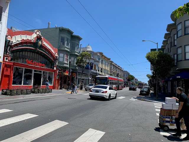
Haight Street, near Ashbury. Unfortunately, the Hippies have long since been gentrified out of this neighborhood.


San Francisco’s “homeless problem” may be overstated by the national media. With the caveat that I did not venture into the Tenderloin, I didn’t see a homeless population in SF any more severe than I might see in Downtown or Midtown Houston. I didn’t have to step over any unhoused person (or their encampments, or their puddles of piss or piles of shit) as I walked along San Francisco’s sidewalks. 

The homeless people that I did see generally kept to themselves and did not accost us for spare change or otherwise make us feel uncomfortable.
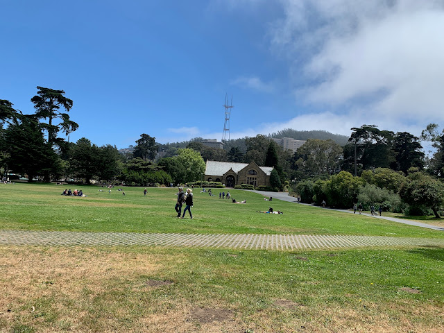
Robin Williams Meadow in Golden Gate Park, with Sharon Art Studio and Sutro Tower in the distance. 


There were, however, signs everywhere around the city warning people not to leave valuables in the their cars. And I noticed that at least one large chain clothing store on Market Street had a line of people waiting to enter; security guards were limiting the number of people who could be in the store at one time, presumably to combat shoplifting.

These were indicators that San Francisco does indeed have a property crime problem that the city is trying to battle. But, as tourists, Corinne and I never felt unsafe anywhere we went.


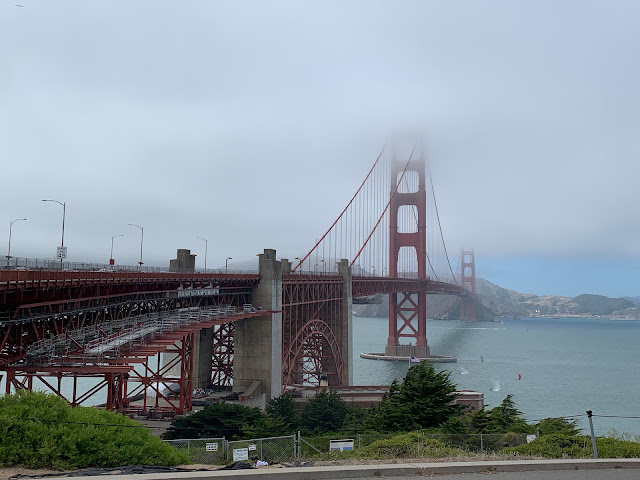
Golden Gate Bridge, as seen from the Visitor's Center on its south end, partially shrouded in fog.


"You just have to see it in person” is a cliché, but in the case of the Golden Gate Bridge, it’s true. I have seen pictures, videos, and movies of the bridge for my entire life, but none of them do it justice. It's hard to appreciate just how big and impressive it is until you've seen it for yourself with your own eyes.  

The bridge, which connects San Francisco with Marin County to the north, opened in 1937.
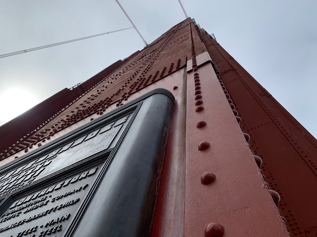
The south tower of Golden Gate Bridge, which rises to a height of 746 feet.


It is possible to bike or walk all the way across the bridge; in fact, we saw people jogging across it. Corinne and I only went as far as the south tower, but we were still treated to a magnificent view of the bay, Alcatraz, and the city. It was cold and windy on the bridge itself, but downtown San Francisco, off in the distance, was bathed in bright sunlight. The city's weather is famously interesting.

The entrance to Fisherman's Wharf. We didn't make it down to Pier 39 to see the sea lions, but we did go to Ghirardelli Square for some chocolate and a beer, so we did a few of the touristy things.


There are so many good seafood restaurants here in Houston. But, respectfully, none of them do crab cakes like they do in Fisherman’s Wharf. Those were surreally delicious. 

In fact, every meal we had in San Francisco, from lunch at a French cafe in Height/Ashbury to dinner at a Thai restaurant in The Castro, was excellent. We weren't in San Francisco long enough to even scratch the surface of all the different cuisines the city has to offer.
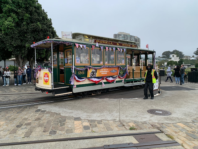
The Powell and Hyde Cable Car turntable near Ghirardelli Square.


We brought the Muni day pass ($5), which allows unlimited rides on buses and light rail for an entire day. This was very convenient for us as we explored the city, although we still did a lot of walking. 

The iconic cable cars are a big tourist draw, and you need a special ticket to ride them (the Muni day pass won't get you on board). We didn't feel like standing in a long line and paying $8 per person just to ride a cable car, but we did have fun watching the cars be manually turned at the end of their route.
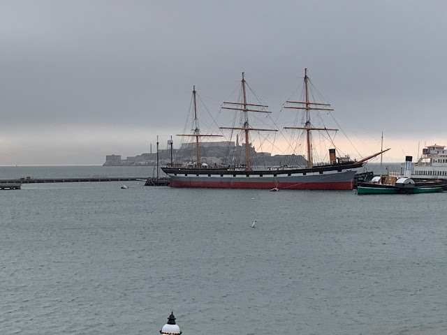
The 1886 rigger Balclutha, with Alcatraz in the background.


As I mentioned previously, San Francisco's weather is famously interesting. During the day, the weather was generally wonderful. Once night fell, however, things got cold rather quickly. "The coldest winter  I ever spent was a summer in San Francisco" may not have been said by Mark Twain, but it's an accurate quote nevertheless.
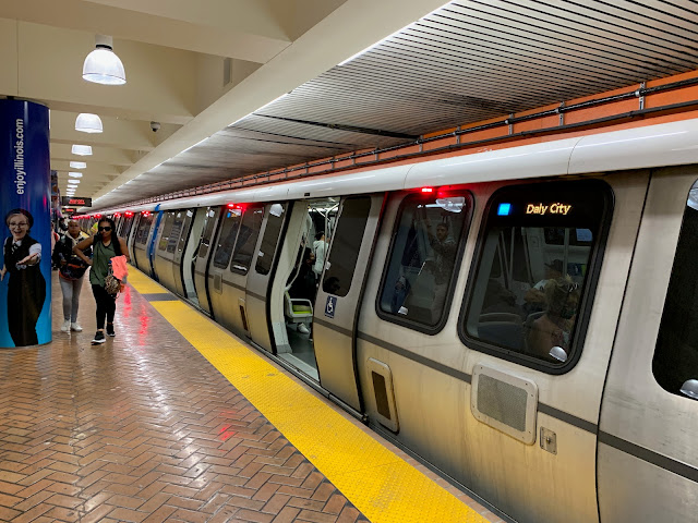
Powell Street BART Station. Along Market Street in downtown San Francisco, MUNI trains run one level below the surface while BART runs two levels below the surface. 


Muni provides transit service in San Francisco itself, while BART (Bay Area Rapid Transit) is a metro system serving the entire Bay Area. Obviously, as a transitgeek I had to take a ride.

As much noterity as the Golden Gate Bridge gets for being an engineering marvel (and it is), the BART Transbay Tube also deserves some recognition. This tunnel, which will celebrate its 50th birthday in just a couple of years, zipped us underneath the Bay from San Francisco to Oakland and back in a matter of minutes. 

Tribune Tower in Downtown Oakland.


The primary purpose of the trip to Oakland was to ride BART; we were in that city just long enough to walk down to Jack London Square and stop in for a drink at a local bar. I was on my best behavior as an Astros fan and refrained from telling A's fans how much their team sucks. 

Jack London Square in downtown Oakland.


The differences in microclimate around the Bay are really amazing. When we took the trip across the bay, it was cold and windy in San Francisco but warm and clear in Oakland. Did I mention that this place has interesting weather?
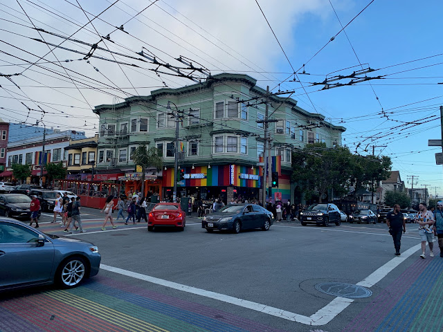
The corner of 18th Street and Castro Street, which is the center of San Francisco's famous "gayborhood." Note the maze of trolleybus catenary wires; the electric motors of Muni's trolleybus fleet handle San Francisco's steep grades better than standard diesel-powered buses. 


Corinne and I have a problem when we travel: we say to ourselves, "let's travel to place X and scratch it off our list of places to see." Then we get there and spend a few days, and realize that there is just so much more to do and see that we have no choice but to return. 

Since we’ve been together, this has been a problem: instead of getting shorter, the travel list keeps getting longer because there are simply so many places we need to return to: Germany, Mexico City, Austria, Venice, Washington DC, Greece, Rome, etc... Now we have to add San Francisco to the list as well. There are entire neighborhoods and attractions - Chinatown, the Embarcadero, the Presidio, Russian Hill, the zoo, Oracle Park, all the museums - that we didn't get a chance to see during our all-too-brief visit.
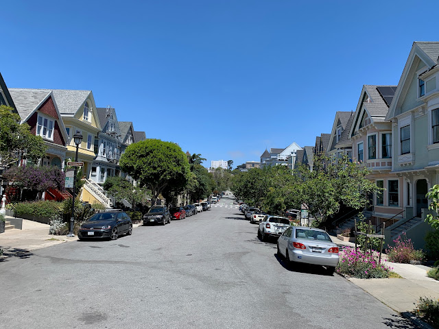
A residential street near Duboce Park.


One final note: Most of what we saw in San Francisco while we walked through it - downtown, Haight/Ashbury, Golden Gate Park, Chrissy Field, Fisherman’s Wharf and the Castro - were normal people doing normal things: hanging out in parks with their kids, fishing off Torpedo Pier, walking their dogs, biking, jogging, having conversations over drinks in outdoor cafes, etc. The city was not a dystopian hellscape.

Does San Francisco have its problems? Yes. Every major city does. However, at a time when this country is horrifically polarized, please do yourself a favor and do not buy into media-driven stereotypes about an entire city.

Thursday, December 15, 2022

Pope Sixtus V

I have a lot of things I'd like to write about from our whirlwind Thanksgiving trip to Italy a few weeks ago, and hopefully I will be getting around to doing so over the next couple of months.

In the meantime, here's one of the first items of interest I came across in Rome: a Pope who was also an urban planner.


Within the Basilica di Santa Maria Maggiore in Rome is the tomb of Pope Sixtus V. He is famous (or perhaps infamous) in the urban planning profession for his ”Plan for Rome,” which consisted of leveling entire neighborhoods within the city in the late 1500s in order to build wide, straight boulevards between the city’s major churches. Although these boulevards made travel through the ancient city easier, he was resented by the large number of households and businesses he displaced. 

His Baroque “urban renewal” scheme would be copied by others, notably by Haussmann in his “Renovation of Paris” in the 19th century... and arguably by American highway engineers of the mid-20th century.

Wednesday, September 07, 2022

Austin skyscraper to be tallest building in Texas

Houston has claimed possession Texas's tallest building for the past forty years. Looks like that's about to change:

Since its completion in 1982, the 75-story JPMorgan Chase Tower on Travis Street in downtown Houston has stood as the tallest building in Texas—an honor that will soon be taken from the Bayou City thanks to a new skyscraper currently under construction in downtown Austin.

As first reported by the Austin American-Statesman's Shonda Novak, Lincoln Development Company and Kairoi Residential announced new details on Tuesday about its partnership on the project. The structure will be called Waterline, according to Novak, and will reach 1,022 feet in the sky by the time of its projected completion in late 2026—placing its peak a mere 20 feet higher than Chase Tower, which measures 1,002 feet.

Downtown Austin's skyline has certainly changed quite a bit since I lived there in the late 90s; as the city has grown, so has its number of tall buildings:

Waterline will join a menagerie of high-rises currently under construction in downtown Austin, which has seen a dramatic boom in population in recent years. According to the Austin Chamber of Commerce, the city's metro area saw a 33 percent population increase between January 2010 and July 2020. More than six percent of its population reported having lived somewhere other than Austin prior to 2019, the country's second-highest rate of recent transplants, per the Austin Chamber.

That growth, unfortunately, has also made Austin one of the least affordable cities for the middle class in the nation, and I doubt the high-end residences planned for this mixed-use tower (it will also have a hotel and office space) are going to make things any more affordable. But that's a topic for another day.

Houston's not likely to wrest back the distinction of being home to Texas' tallest tower. Construction of any building over 200 feet in Houston requires consultation from the Federal Aviation Administration, which has previously raised concerns with downtown building plans in excess of 75 stories, citing the importance of safeguarding air space for flights in and out of nearby William P. Hobby Airport. The Chase Tower, originally known as the Texas Commerce Tower, was initially intended to stand 80 stories tall before an FAA analysis prompted the City of Houston to ask for its design to be shaved down to 75 stories. The city has not approved any design exceeding this benchmark.

Downtown's proximity to the approach path to Hobby Airport is, in fact, one of the reasons why another tower planned for Houston in the early 1980s - a 1,400-foot, 82-story, Helmut Jahn-designed project that would have been the second tallest building in the United States at the time (see rendering here) - was never built, either. Of course, the oil bust had a role to play in its cancelation as well.

Tuesday, December 21, 2021

RIP Richard Rogers

Another one of my favorite architects has shuffled off this mortal coil:
Pritzker Prize-winning architect Richard Rogers, whose landmark buildings include the Centre Pompidou in Paris, the 3 World Trade Center tower in New York and London's Millennium Dome, has died aged 88. Rogers "passed away quietly" on Saturday evening, his representative Matthew Freud of Freud Communications confirmed to CNN on Sunday.

He was one of the most distinctive architects of his generation, with an architectural style that was both instantly recognizable and highly adaptable.
My favorite Rogers building - in fact, one of my favorite buildings overall - is the Lloyd's of London headquarters, which he designed back in the '80s.
In 1986, Rogers, then working as the Richard Rogers Partnership, would complete another famous building in the same style: the Lloyd's of London headquarters. It, too, was heavily criticized at first, but it is now one of the city's most iconic buildings. In 2011, the Lloyd's building received Grade I listed status, making it one of the few modern buildings to receive Britain's most prestigious designation.
Like the Pompidiou Center, the Lloyd's building is an example of "Bowellism" or "inside-out" architecture closely associated with Rogers, wherein normally "internal" facilities such as elevators, stairwells and HVAC ducts are moved to the exterior of the building, in order to a) maximize internal open space and b) make the building more interesting to look at.
The architect also received the Pritzker Prize -- popularly known as the Nobel Prize of architecture -- in 2007. 
Rogers was knighted by Queen Elizabeth II in 1991. In 1996, he was made a life peer for the Labour Party and created Baron Rogers of Riverside.
Not a bad life. Thank you, Sir Rogers, and rest in peace.

Wednesday, October 07, 2020

Houston sees surge in bicycling

More locals are traveling on two wheels, thanks to the coronavirus pandemic:

Coupled with the effects of a warming planet, Covid-19 has produced little good news this year. Yet the two crises did pave the way for one positive social shift: a bike boom, including in some unlikely places. New data from Strava, the fitness tracking app used by 68 million global users, shows that several U.S. cities saw significant year-over-year growth in both bike trips and cyclists in much of 2020. 

Among the six U.S. cities for which Strava provided data, Houston and Los Angeles, two sprawling metropolises where just .5% and 1% of the respective populations biked to work in pre-pandemic times, stand out. In Houston, the total volume of cycling trips in Houston was 138% higher in May 2020 than in May 2019. In Los Angeles, the jump was 93%. Unlike their peers, these two places also saw cycling increases in April, the first full month of widespread stay-at-home order and economic shutdowns. 

Given that riding a bicycle is a socially-distanced, outdoor activity, it should come as no surprise that  Houstonians tired of being locked into their homes began to hop aboard their bikes. Activity on the Houston BCycle bike share system saw dramatic increases shortly after the pandemic began, and people wanting bicycles of their own wiped out the inventories of places like Academy and Bike Barn. 

Cycling experts on the ground confirmed that the new Strava numbers are consistent with data from local bike-counters and bike-share systems. In Houston, one popular trail has seen a 162% increase in trips from January to August of this year, said Susan Jaworski*, an active transportation planner for the Houston-Galveston Area Council, a consortium of regional cities that helps coordinate bike networks.

“I think it was the pandemic’s stay-home, stay-safe orders, where people who were remote-working had a chance to discover their bikes,” she said. “When congestion disappeared overnight, I think more folks felt comfortable exploring to get fresh air.”

The big question is if automobile-oriented cities such as Houston will be able to keep people on their bikes even after the pandemic ends and regular commuting and exercising activity resumes. Houston has aggressively been trying to expand its investment in bike-friendly infrastructure, but the city's long-standing affinity for the automobile, as well as its harsh summertime climate, remain to be overcome.

Bicycling is a healthy, inexpensive, ecologically-friendly way to travel and recreate. If anything good comes out of this pandemic, it's that more Houstonians discovered this for themselves.

* Full disclosure: Susan Jaworski is a co-worker of mine at H-GAC.

Sunday, August 30, 2020

RIP Gerald Hines

I would venture to say that no single person has impacted Houston's skyline more than Gerald D. Hines. The legendary developer passed away last weekend at the age of 95:
Hines, who launched his property company as a one-man shop in Houston in 1957, developed billions of dollars’ worth of real estate across the globe, influencing generations of builders and leaving a lasting mark on the world’s top cities. 
The founder and chairman of the Hines firm was one of the first developers to hire sought-after architects, proving that tenants would flock to top-quality buildings, even in a down market. He raised the bar for commercial real estate by showing that quality and financial success could be mutually attainable. 
“Gerald Hines was one of the great patrons of American architecture of the 20th century,” said architectural historian Stephen Fox, putting him in a category with John and Dominique de Menil, Ima Hogg and her brother William, and Edgar Odell Lovett, the first president of Rice University. 
“He put Houston on the map in terms of architecture by his imaginativeness and his business discipline in understanding how he could work with the best architects of the world within the economic constraints of real estate development and construction,” said Fox, a lecturer at the architecture schools at Rice and University of Houston.
Hines and his development firm were responsible for many of Houston's most iconic buildings, including One Shell Plaza, Pennzoil Place, the TC Energy (originally RepublicBank) Center, the JP Morgan Chase (formerly Texas Commerce) Tower, the Transco (now Williams) Tower, and the Galleria. The JP Morgan Chase Tower, built in 1982, remains Texas's tallest building, while the Williams Tower, opened in 1983, remains the tallest building in the United States located outside of a central business district. In addition to his Houston developments, Hines was responsible for notable buildings in places such as New York, San Francisco, Chicago, and Dallas.
Downtown’s Pennzoil Place represented a breakthrough for Hines from a design and development standpoint. The twin 36-story trapezoidal towers of darkly tinted glass was named “Building of the Decade” when it was completed in 1975 by the late New York Times architecture critic Ada Louise Huxtable. 
Hines collaborated on the project with architects Philip Johnson and John Burgee who turned away from the boxy modern design of the era exemplified in One Shell Plaza just up the street. 
“In so doing they demonstrated that if you make a building that is distinctive there are tenants that will pay extra to have their offices there,” Fox said. “That was kind of the Hines breakthrough — to understand and respect the power of architecture to create structures potential clients would want to identify with.” 
Hines worked with Johnson and Burgee on multiple projects, including the so-called “Lipstick Building” at 53rd at Third in midtown Manhattan, a 34-story elliptical-shaped office tower completed in 1986; and San Francisco’s 101 California, completed in 1982, a cylindrical 48-story tower of glass and granite and glass, featuring a seven-story, glass-enclosed lobby. 
Hines developed friendships with many of the architects who designed his buildings. For his 90th birthday, he was joined by seven of them to discuss design and development in a public architecture forum at Houston’s Hobby Center. Hines sat alongside Burgee, A. Eugene Kohn, Henry Cobb, Cesar Pelli, Robert A.M. Stern, Jon Pickard and Art Gensler who talked of Hines’ outsize influence on commercial real estate. The event drew an audience of more than 2,000. 
“Our best work was for Gerry Hines,” Burgee, who, along with the late Philip Johnson designed several buildings for Hines, said at the forum.
Given his patronage of some of the era's most notable architects, perhaps it is only natural that Hines also lent his support the next generation as well:
Hines’ philanthropic contributions included a $7 million donation in 1997 to the University of Houston’s architecture school that now bears his name. 
When he spoke to students, Dean Patricia Belton Oliver said, there was an immediate connection and mutual respect. 
“I never saw him light up quite the way he did when he was surrounded by students,” she said. “For someone who made his career in such a tough business, it was so gratifying to see the joy he experienced when he had the opportunity to share his legacy.”
Discussions about Hines' contribution to the UH College of Architecture occurred towards the end of my time as a student there, and I remember it being controversial at the time. Some students were miffed that the college "sold out" to a developer, rather than an actual architect. Never mind the fact that, without developers, architects wouldn't have any business at all!

I never got to meet Hines in person, although I was among a group of UH architecture students who was invited for a luncheon at his River Oaks mansion, which was rather impressive.

Hines' firm continues to operate under the direction of his son, Jeffery. A tribute to Hines on the company's website is worth a read. The UH College of Architecture has put up a tribute as well.

Tuesday, July 14, 2020

The conservative case against single-family zoning

Charles Marohn argues that "there is no greater distortion of the market than local zoning codes" and calls for the elimination of single-family zoning on "small government" principles:
The first of many ironies, of course, is that single-family zoning became the standard for American suburbs during the New Deal when the Roosevelt administration, through various programs such as the Home Owners Loan Corporation, required it for home refinancing assistance. 
These onerous regulations were further mandated for new construction by the Federal Housing Administration as well as the government-sponsored enterprises Fannie Mae and Freddie Mac. 
So if you want federal support for your housing, build a single-family home. If you want to live in that downtown shop with the house on the second floor, convert your house to a two- or three-unit building and rent it out—or do any number of normal and reasonable things that humans had been doing with their property for centuries to build their own wealth and prosperity—don’t expect assistance from the government. 
Yet now that we’ve lived with this artificial distortion for a couple of generations, and piled on others like the mortgage-interest tax deduction, some strange conservative instinct kicks in to defend this bankrupt institution. In reality, the Pilgrims built a traditional town surrounded by farmland. Our government paid us to move to the suburbs. Invoking the memory of the former to defend the latter is an historical absurdity.
Marohn's knockdown against single-family zoning was apparently triggered by an article by Stanley Kurtz in the National Review which claimed that Joe Biden and the Democrats want to "abolish the suburbs."  This claim, which has also been made by Donald Trump and is centered around the Affirmatively Furthering Fair Housing provision of the 1968 Fair Housing Act, is dubious. Marohn argues that, if conservatives were intellectually honest, they would be demanding an end to single-family suburban development on the grounds of economic efficiency: 
The suburbs run on federal subsidies. Without them, America’s suburbs would have to become more financially productive. They would need to get greater returns per foot on public infrastructure investment. That would mean repealing repressive zoning regulations, allowing the market to respond to supply and demand signals for housing. It would also mean allowing the “little downtowns” Kurtz fears to form where demand for them exists. Isn’t that what is supposed to happen with self-government and local control? 
All this would have to happen or the suburbs would go away because they can’t exist without excessive and ongoing federal subsidy. 
The progressive left has discovered that single-family zoning has racist underpinnings. That’s great, because we should now have no problem finding common cause for repealing this most distorting of regulations, one that the federal government never should have forced cities to adopt to begin with. 
In fact, the conservative thing for suburban leaders to do here is to not wait for the federal government to tempt us with more handouts, but to go ahead and show those progressives running the big cities that we live by our principles, that we embrace vibrant markets and free people, by preemptively repealing single-family zoning.
While I'm not sure I agree with Marohn's implication that single-family zoning is largely the result of "big government" (as opposed to a largely locally-driven effort fueled by NIMBYism), I do agree with him that single-family zoning is, like minimum parking regulations, a relic of late-20th-century land use control that needs to be phased out. Zoning started out in the early 20th century as a way to protect residences from nuisance uses such as factories or slaughterhouses, but it has evolved into a tool to enforce socioeconomic exclusion. 

Anybody who has read this blog knows that I, a former zoning officer for the city of Denton, am not a fan of traditional land-use zoning, and am thankful that Houston is the largest city in the nation without it.

Saturday, June 27, 2020

Pandemic Link Dump

Passing along a handful of random articles and topics I've come across over the last month or so...

Urban freeways are a product of racial injustice, and its effects are still being felt here in Houston.  I've touched on this before, and in the wake of the protests for racial justice sparked by the murder of George Floyd, it's become a topic once again. Urban freeways were largely built through minority neighborhoods, dividing and displacing their inhabitants. Decades later, those scars remain:
Thousands of peaceful protesters in the Twin Cities occupied Interstate 94 over the weekend as they marched from the Minnesota State Capitol in St. Paul to Minneapolis. 
For the region’s African-American community, which has been leading the ongoing protests over the fatal arrest of George Floyd and the use of police force on black Americans, the concrete they were standing on bears significant meaning. 
It was this highway that, in the 1950s and ‘60s, tore apart the once-thriving neighborhood of Rondo — the heart of St. Paul’s largest African-American community — and helped spur decades of racial segregation in the region. 
Minnesota Governor Tim Walz acknowledged as much during a Saturday press conference. "It wasn’t just physical — it ripped a culture, it ripped who we were. It was an indiscriminate act that said this community doesn’t matter, it’s invisible,” he said. “This convenient place to put a highway so we can cross over this place and go from the city out to the suburbs.”
The once and future effects of these freeways remain a topic of controversy today, even here in Houston as TxDOT continues forward in it plan to reconstruct IH-45 north:
Members of the Houston-Galveston Area Council’s transportation advisory committee this week voted to keep portions of the I-45 project in the area’s short-term transportation plan, but with a host of caveats. Chief among those conditions is that the Texas Department of Transportation respond in detail to a set of requests from Houston planners outlining exactly what they can and cannot do to stay within the freeway’s existing boundary and agree in writing to protect displaced residents and businesses. 
The lack of clear commitments worries skeptics, who fear neighborhoods affected by the massive redesign from downtown north to Beltway 8, such as Northside, Independence Heights and Fifth Ward, will continue to bear the brunt of TxDOT and Houston’s highway expansion. For decades, neighborhoods along I-45, I-69 and I-10 north and east of downtown have felt the effects of living within shouting distance of the freeways, as mostly white officials routed the thoroughfares through black and Hispanic communities. 
“A vote on this project that continues those very systems of oppression, disparity and racial inequities without addressing the real problems is only supporting and continuing that system of racism,” said Oni Blair, a member of the transportation advisory committee and executive director of LINK Houston, an advocacy group that has organized opposition to the I-45 plan.
The IH-45 north rebuild provides an opportunity to improve the freeway while at the same time address the impacts that the freeway has historically had on adjacent communities. TxDOT needs to listen carefully, and not repeat the mistakes of the past:
“To leave I-45 as it is currently configured would be a mistake,” said Carol Lewis, director of Texas Southern University’s Center of Transportation Training and Research. 
Ignoring the issue of social justice would be, too, she said. TxDOT has gone to historic lengths to solicit comment but must now reconcile those concerns with its plans and the engineering analysis of how the new freeway and changes to it will affect how people and freight move. 
What is clear, Lewis said, is that TxDOT cannot brush aside how the freeways got where they are now. 
“I think historically TxDOT has been 100 percent guilty of being 100 percent insensitive,” Lewis said, noting what is now I-69 along the east side of downtown gutted Fifth Ward.
How do we get people back on the bus? I wrote a couple of months ago about the essential role of public transportation during the Coronavirus crisis. Now, as local economies reopen, transit agencies need to convince "non-essential" commuters that it is safe to start using transit again:
Masks are mandatory on subways and buses in Washington. San Francisco is betting longer trains will help riders social distance. Crews disinfect New York’s trains daily -- stations twice a day -- and are testing ultraviolet light devices to see if they kill Covid-19 on surfaces. 
As states gradually reopen, transit agencies are taking steps to coax back passengers who’ve been told for months to avoid just such tight quarters with strangers -- an effort that will ultimately influence the economic recovery. 
“For certain businesses teleworking isn’t really an option, so we still need to figure out ways to get those people to work,” said Ed Mortimer, vice president of transportation and infrastructure at the U.S. Chamber of Commerce. 
Especially in urban areas, where many people don’t own cars, mass transit will be crucial to reviving economies. But enticing passengers back on board may require adding trains and buses so people can space themselves further apart -- adding stress to agencies already reeling from declining ridership and rising cleaning costs.
Public transportation might not be the disease vector it's feared to be, but it's understandable that people are going to be wary of crowding on board buses and trains with other strangers. Transit agencies are poised for a slow and difficult recovery, especially since people are likely to commute differently in a post-COVID world, and they probably need to re-think the way they provide service and define success both during and after the pandemic. That being said, our cities will not experience full economic recovery unless their transit networks also recover.

Could Houston become a climate policy leader? Maybe:
April was supposed to be a big month for Houston city planning. America’s largest unzoned city was poised to host the American Planning Association’s national convention for the first time, bringing thousands of attendees to town. Walking tours were arranged; awkward cocktail mixers were scheduled. 
Of course, with a global outbreak of the coronavirus, it wasn’t meant to be.
I cannot begin to express how much I was looking forward to the APA's National Planning Conference being here in Houston, as I had never attended this event before. Likewise, I cannot begin to express how bummed I was when it was canceled in the midst of the Coronavirus pandemic. I hope the APA makes plans to return to Houston with this is all over.
Undeterred, Houston quietly adopted the Bayou City’s first citywide climate action plan on the 50th anniversary of Earth Day. If city leaders can pull it off, America’s sprawling oil capital could end up teaching a lot to more traditionally green urban strongholds.
The city's climate action plan is intended to be a blueprint to Houston reducing its impact on the environment. Given the city's characteristics - the refineries, the sprawl - that's going to be a challenge, so the plan includes both standard and innovative elements.
The plan includes plenty of mainstay climate-policy prescriptions, including calls to electrify the city’s fleet of vehicles, switch to renewable sources of energy, and improve energy efficiency in buildings. But then things become rather unique. The city’s first bicycle master plan, adopted in 2017, gets a lot of play, as does the MetroNEXT Moving Forward plan, a widely lauded $3.5 billion push to overhaul mass transit in the notoriously auto-oriented city. The emphasis on mobility makes sense, since nearly one-third of U.S. greenhouse gas emissions come from transportation, and Houston maintains one of the highest rates of automobile use in the country. 
Toward this same end, one of the plan’s more innovative proposals calls on policymakers to eliminate minimum parking requirements by 2030. While Houston famously lacks zoning — meaning that it doesn’t segregate uses or restrict densities — it still enforces some conventional land-use regulations. These include minimum parking requirements, which mandate that developers build off-street parking for each project, regardless of actual demand. In Houston, this can mean up to two parking spaces for every apartment or four spaces for every thousand square feet of office space.
Houston's lack of zoning, furthermore, might make it easier for the city to redevelop in a sustainable manner, featuring more walkable, mixed-use, higher-density development, than other cities that are incumbered by an onerous development process that is subject to NIMBY interference.
The city has a long way to go before it becomes anyone’s idea of an environmental exemplar. But if all goes according to plan, Houston could soon rank among those cities that have scrapped out-of-date parking requirements — a group that conspicuously doesn’t include progressive stalwarts like Portland and New York City. In a city otherwise famous for its supposed lack of planning, easing up on the right rules might just turn Houston green.
Stay tuned.

"The right thing - just at the wrong time." Take a few minutes to read this excellent XFL postmortem by ESPN's Kevin Seifert. The article takes a look at why the well-funded league suddenly folded (it might not have been completely due to Coronavirus), it's prospects for revival, and the potential for spring football generally:
"We still don't know that spring football works in this country," said Andrew Kline, founder of the investment bank Park Lane, which specializes in sports investments. "Football season is so intense, and it's just associated with the fall season. You wonder if part of the cycle is that people need to come down from it for a while."
I'm obviously a fan of spring football, but its track record is dismal, and as even as the XFL winds its way through bankruptcy proceedings, I'm skeptical that we'll ever see another Houston Roughnecks game again. At any rate, it appears that we could have to go for awhile without any football at all. Which will make my fall miserable, to say the least.

The removal of Confederate statues and monuments should not be a "liberal" endeavor. I can't believe I'm actually linking to Rich Lowry in the National Review, but in this case he's right:
Conservatives […] reflexively oppose politically correct campaigns to destroy anything giving offense. 
They fear where the slippery slope of woke iconoclasm will lead — first it’s Jefferson Davis, ultimately George Washington. 
They value tradition and worry we are trashing part of our history.This impulse, though, is a mistake. Confederate statues and symbols deserve to be reevaluated, and often mothballed. 
The statues are an unnecessary affront to black citizens, who shouldn’t have to see defenders of chattel slavery put on a pedestal, literally. 
It is impossible to evaluate these monuments without considering the context of why they were created. Many of them were erected as part of the push to enshrine a dishonest, prettied-up version of the Confederacy.
Lowry ends by noting that "secession was a traitorous act that threatened to destroy the American nation, to create a rump republic built on slavery, and to make impossible the subsequent rise of the United States to a world power." Liberals and conservatives alike should understand the fact that the Confederate States of America was, quite simply, a racist and treasonous enterprise that was defeated over a century and a half ago.

I occasionally come across the argument that the removal of Confederate statues and monuments is somehow "erasing history." This is bullshit. There are no monuments to Hitler or Rommel or Göring in Germany, but we still know that county's history - a history the German people of today most certainly do not want commemorate.

These statues and monuments belong in museums, battlefields, and military cemeteries. They do not belong in our parks, our squares or our capitol grounds.

Last but not least, congratulations to Liverpool.

Thursday, November 21, 2019

Starchitects, high-rises and Quito

I recently wrote about the potentially transformative effect of a new subway in Quito, Ecuador. One of the subway's intended effects is to create density by encouraging more high-rise construction around stations. Architectural Digest explains how some of the world's top architects are participating in that transformation: "Initiated by an enterprising local developer and fueled by a revised zoning code and new transit-oriented development incentives, Quito is shaping up to be a starchitect’s next frontier."
The urban shift in Quito started with a relocation. In February 2013, the municipal government moved the entirety of Quito’s 1960 Mariscal Sucre International Airport from the dense residential and commercial neighborhood that had grown around it to an agricultural area 12 miles away. The previous location of the airport (now being transformed into a large park) had capped surrounding building heights at four stories. A revised zoning code now allows towers in the city up to 40 stories, though air rights must be purchased from the government.
As fun as it was to watch the planes fly overhead on their final approach to the old airport - I used to sit at the window and watch the 747s of Lufthansa and KLM, the DC-10s of Iberia, the colorful 707s of Ecuatoriana and even the droning Lockheed Electra turboprops of TAME - the flight path was rather treacherous, given the city's geography. It was also rather loud. Quito's new airport is larger, with a longer runway and a flight path the does not require you to land in the middle of a city crammed up against a volcano.
Recognizing the new potential to build taller and better, Quito-based development company Uribe & Schwarzkopf has been recruiting world famous architects with a "why not here?" attitude. For the 46-year-old, two-generation company where father Tommy Schwarzkopf and son Joseph Schwarzkopf work side by side, it became increasingly obvious that sometimes you can't do it all. For about the last 40 years, the firm had taken a design-build approach, with Tommy (a trained architect) at the helm of designing modular residential and commercial towers across the capital. The buildings are efficient, but far from radical, on a growing skyline. When Joseph came into the family company, the two hypothesized that starchitects could bring more intrigue to their projects, and Tommy says he was satisfied to hand over the design reins and accept a new development challenge. 
Thus, their firm’s first foreigner-designed tower sprung up in González Suárez, an artsy, bohemian, and increasingly affluent neighborhood on a slope. The developers called on Miami-based Arquitectonica to design the 22-story residential Yoo Quito. French designer Philippe Starck crafted the interiors and amenities, which are dotted with his furniture and inspired by the clouds the tower seems to touch. Floating above the roof terrace is a cloudlike shape of undulating aluminum panels that hides the building’s necessary mechanical systems. On the ground level, too, the tower does something new for Quito: Retail at the base engages the public with the building in a city where most private residences have a barrier to entry.
I know exactly where Yoo Quito is - on Avenida Gonzalez Suarez, between Avenida Francisco de Orellana and Calle Muros - because it is directly across the street from the small apart-hotel on Calle Muros where my family and I lived in the late 1980s when we spent our summers in Ecuador. That part of town always had high-rises, both along Gonzalez Suarez as well as Avenida 12 de Octubre. Now, if local officials have their way, the rest of the city will start going vertical as well.
The government is, however, working to increase city center density through the city's first underground metro line, whose first phase will run from north of the former airport to the southern suburbs in 2020. Explains Jacobo Herdoiza, a former secretary of territory for Quito, the hope is that upper-class residents who currently drive from the suburbs to work downtown each morning will ditch their cars for mass transit and move back to the city center. For developers, an incentive has been set in place: If you construct a new residential project within an eight-minute walk from the new metro or a five-minute walk from a bus rapid transit station, the city will pick up the tab for your air rights.
The article claims that "Quito suffers from a pedestrian-unfriendly urban streetscape." I'm not sure I would completely agree - some parts of Quito, such as the colonial center or the Mariscal Sucre district, offer a good, active pedestrian environment - but the city is otherwise mostly automobile-oriented and I recall that many Quito sidewalks were narrow, uneven or poorly-maintained, with cars in driveways blocking them, a lack of curb cuts and other accessible infrastructure, and blank, uncomfortable security walls adjacent to them. Good pedestrian infrastructure is critical to the success of transit, and this is where transit-oriented development comes in to play.
These transit-oriented development incentives convinced Uribe & Schwarzkopf to hire one of the world's most buzzy architects, Bjarke Ingels of BIG, to design two residential towers (the firm's first projects in Latin America) along the forthcoming metro line. Across from La Carolina Park, the city's most popular green space, the 32-story IQON and the 24-story EPIQ towers by the architect are quickly rising. The former is set to be the city's tallest building and has a facade that, when trees are planted on each terrace, will reflect the adjacent park. The latter takes a more historic approach to its materials: It will be constructed of concrete dyed in various shades of pink to reflect Quito's terra-cotta heritage. Green roofs atop each setback become communal terraces for residents, while the ground level is activated with retail, offices, and a restaurant, a strategy that is hoped to encourage pedestrian traffic.
To be sure, these signature starchitect luxury high-rises are only part of the transformation process. Ecuador is still a low-income country and the percentage of the population that can afford to live in them is low. In order for the process to truly work and for Quito to reach its potential as a vibrant, walkable city, a lot of less-iconic but more-affordable housing options will need to be constructed as well. But by giving famous architects a "canvas" for their designs, perhaps an impetus can be created in Quito's development community for dense, mixed-use and pedestrian-friendly construction for all income levels. As the developer Tommy Schwarzkopf explains: “A new skyline for the city is being created and a new type of citizen is emerging.”

Did I mention that it's time for me to go back to Quito?

Thursday, November 07, 2019

Autonomous vehicles will only be as safe as their software

About a year and a half ago, an autonomous vehicle being tested in Arizona struck and killed a pedestrian. It was the first-ever fatality involving a self-driving car. Now, we may know why this incident occurred: the vehicle's software didn't know that humans could jaywalk:
The software inside the Uber self-driving SUV that killed an Arizona woman last year was not designed to detect pedestrians outside of a crosswalk, according to new documents released as part of a federal investigation into the incident. That’s the most damning revelation in a trove of new documents related to the crash, but other details indicate that, in a variety of ways, Uber’s self-driving tech failed to consider how humans actually operate.
As it turned out, the vehicle's software did detect the victim, 49-year-old Elaine Herzberg, with more than enough time to stop, but did not do so because it did not recognize that Herzberg was, in fact, a human. (The car did have a human back-up driver, Rafaela Vasquez, but she didn't see Herzberg until it was too late.)
It never guessed Herzberg was on foot for a simple, galling reason: Uber didn’t tell its car to look for pedestrians outside of crosswalks. “The system design did not include a consideration for jaywalking pedestrians,” the NTSB’s Vehicle Automation Report reads. Every time it tried a new guess, it restarted the process of predicting where the mysterious object—Herzberg—was headed. It wasn’t until 1.2 seconds before the impact that the system recognized that the SUV was going to hit Herzberg, that it couldn’t steer around her, and that it needed to slam on the brakes.
That triggered what Uber called “action suppression,” in which the system held off braking for one second while it verified “the nature of the detected hazard”—a second during which the safety operator, Uber’s most important and last line of defense, could have taken control of the car and hit the brakes herself. But Vasquez wasn’t looking at the road during that second. So with 0.2 seconds left before impact, the car sounded an audio alarm, and Vasquez took the steering wheel, disengaging the autonomous system. Nearly a full second after striking Herzberg, Vasquez hit the brakes.
Self-driving vehicles will only be as safe as the design of the systems, sensors and software upon which they operate. The software design flaw that occurred in this case - an inability to recognize a human outside of a marked crosswalk - is so obvious as to beggar belief, and makes me wonder how many less-obvious but nevertheless lethal programming errors might still be imbedded in Uber's self-driving software. This is one of many reasons why we still have a long way to go before self-driving cars become commonplace on streets and highways.

Uber settled a lawsuit with Herzberg's family shortly after her death, and has made changes to its safety program for automated vehicle testing.

There's also this tidbit:
Another factor in the crash was the Tempe road structure itself. Herzberg, wheeling a bicycle, crossed the street near a pathway that appeared purpose-built for walkers, but was 360 feet from the nearest crosswalk.
Yikes! Along with the safety of autonomous vehicles themselves, we cannot ignore the design of the environment in which they - and the pedestrians and bicyclists they are supposed to detect - travel. The safe deployment of self-driving cars could require significant and expensive modifications to streets, sidewalks, pathway and bikeways.

A lot of work remains to be done.

Quito, Ecuador: the city and its subway

Curbed's Jeff Andrews writes a fascinating history about the capital of Ecuador, its historic urban form, the changes to that urban form caused by continued growth, and the fact that these changes have required the city to build a subway.
Looking down on the city of Quito from the teleférico that rides up the eastern slope of the Pichincha Volcano, buildings as high as 30 stories dot an urban landscape that includes the former citadels and centuries-old churches of what was once a Spanish colony. 
But someone looking at Quito from that same view 50 years ago would have seen a considerably smaller city full not of high rises but of single-family homes. 
The discovery of oil in Ecuador in the late 1960s triggered growth in the country’s capital that pushed the city not only out but up. Quito’s population has grown from 350,000 then to almost 3 million today. 
Now, Quito’s transformation from sleepy town to vibrant metropolis is entering perhaps its most important phase: The population explosion has created the need to overhaul the city’s transportation infrastructure. Having already moved its airport out of the city center, Quito will open a brand new subway line in 2020, just seven years after the first phase of construction began. The metro could usher Quito into a new era as a regional economic power.
Quito is highly geographically constrained, with Mount Pichincha to its west and the Tumbaco Valley to its east. While the city has seen some residential development spill over into the Valley in recent decades, these geographic constraints otherwise means that the city's urban core can really can only grow in two directions - north and south. As a result, Quito's core is over twenty miles in length, but only about two and a half miles in width at its narrowest points.

This, necessarily, means that north-south commutes are the norm, which in turn causes significant congestion:
Quito’s topography, shaped by the city’s position in a valley of the Andes, provides residents with breathtaking views of the two mountain peaks on either side of the city. But as the city’s population has ballooned, Quito’s topography also contributes to traffic problems weighing on the city. 
Take El Panecillo, a hill in the center of Quito, just south of the city’s historic Old Town. On top of it lay a 135-foot-tall aluminum statue of a winged version of the virgin Mary, known locally as the Virgin of Quito. The statue is visible throughout Quito and is a source of local pride.
The hill is also an impediment at the center of traffic flow between the north and the south, as is the Old City itself, which has narrow roads originally built in the 16th century. Numerous ravines snake down the mountains in the east and cut through Quito’s center before flowing down to the valleys in the west. The bridges and infrastructure over these ravines weren’t built for the number of cars that now use them, and the available public land for new roads is limited, narrow, and expensive. 
The result is, for some commuting Quiteños, a traffic nightmare.
“The economic booms and the consumer patterns in Quito are very car-oriented,” [former Secretary of Territory for the Municipality of Quito Jacobo] Herdoiza said. “One of the first priorities for a new labor force is to have their own car. So you have an increase in the number of vehicles that doesn’t match with improvements in road networks or in public transportation.”
I remember very clearly how chaotic Quito's transportation network when I spent my summers there in the late 1980s; the city, while already large, was much smaller then than it is today.

Beginning in the 1990s, municipal officials tried to combat congestion by improving public transportation options. The Trolebus, an electrically-powered Bus Rapid Transit line running in the median of major Quito thoroughfares such as Avenida Diez de Agosto, opened in 1995. Diesel-powered BRT lines, such as the Ecovia and Metrobus, opened thereafter. Given the fact that Ecuador is an impoverished country, this type of transit infrastructure was probably all that was fiscally feasible at the time. But as at-grade bus systems, the Trolebus and Ecovia were limited in terms of the parts of the city they could serve and the number of riders they could carry. These riders were, for the most part, laborers commuting from the working-class neighborhoods on the south side of town to the businesses and industries in the north.
These commuters have to deal with every topographical impediment the city center has. Only about a third of Quiteños own a car. The rest rely on existing public transportation—the bus system and the bus rapid transit (BRT) system, or trolley buses that run north-south along major avenues. Low-income people in the south who work in the north often have to take multiple modes of transportation, spending as much as 20 percent of their income on that transportation. The commute can be as long as two hours each way, with delays caused by bus drivers who, Correa says, often bypass stops with fewer passengers in favor of more crowded stops that bring in more fares. Laborers who spend four hours on a bus every day not only waste time they could be working or being with their families, but they’re also exhausted during work hours from the long commute.
Thus, the Quito Metro, which is completely underground and which will run for about 14 miles along a north-south route featuring 15 stations. The project began construction in 2013 and is expected to open in 2020. Building a full subway - especially one beneath and earthquake-prone city - is an ambitious project for a relatively low-income country. But it could be transformative to both Quito's mobility and its urban form.
The metro alone will not solve these problems, of course. Because it only runs north-south through the city center, it won’t do much to alleviate congestion along Quito’s second busiest commuting route—people in the valleys who drive to Quito’s business district in the middle of the city center. 
And the metro stops also are not close to each other—1.5 kilometers apart, on average—so the metro will need to integrate into the existing system to truly meet commuters’ needs. At worst, the bus system and BRT could end up competing with the metro instead of working in concert with it, jeopardizing the financial sustainability of the subway.
If local officials can't get a subway, a BRT network and local bus systems to work together to provide complementary and interconnected services - e.g. longer north-south trips on subway, shorter north-south trips on BRT, and east-west and feeder trips on local bus - rather than competing services, then they're doing it wrong (and they need to hire someone like me to help them figure it out).
But if it works, the metro could unlock Quito’s potential to be a regional economic power. New developments around the metro stops are already well underway, which could create pockets of urban density that allow for more walkability and less reliance on cars and buses, something that younger Quiteños desire.
Quito already sees itself as something of a hidden treasure in Latin America, with a budding nightlife and restaurant scenes, and tourist attractions to rival any city on the continent. With two new ways of getting around the city, and phase one of an ambitious new metro system that took only seven years to complete, Quito may not be “hidden” for much longer.
Just another reason why I need to go back.