Showing posts with label public transportation. Show all posts

Wednesday, December 18, 2024

RIP Janis Scott

A local legend is gone.

Janis Scott, a fixture of community meetings and public lectures who was lovingly called “the bus lady” by four generations of Houstonians, died Monday. She was 73.

A nearly lifetime bus rider — there was a time in the 80s when she bought a car but ditched driving after a few years — Scott was one of the most passionate advocates for Metropolitan Transit Authority service, specifically frequent buses crisscrossing oft-neglected communities.

"Janis was one of many riders who kept us accountable for providing good service,” former Metro board member Christof Spieler said. “But she stood out for the thoughtfulness of her comments, the way she stepped back to consider the needs of all the other riders as well, her caring for the bus operators who took her around Houston, and her love of the city and its transit system. She will be missed."

Beyond the bus Scott was a “lifelong learner” who “regularly attended public events with speakers from around the country,” said her friend, Oni Blair.

I knew Janis through my work, as she participated in transit-related workgroups and attended subcommittee meetings I was involved in. I'd oftentimes spend time chatting with her after meetings and listening to her stories. Even during the pandemic, when our transit subcommittee meetings were held virtually, she would call in to listen and then call me directly afterwards to share her thoughts on the discussions that had just transpired.

I would also occasionally see her at METRO Board meetings, where she was a fixture.

“Metro is a lifeline for many of us — it’s a mandate and a civil right,” Scott wrote in an essay for the Kinder institute for Urban Research at Rice University. “If you do not have a car, public transit gives you access to many opportunities, including jobs, medical appointments, education and what I call life, liberty, and the pursuit of happiness! Transit justice is a form of freedom, where sidewalks and curb cuts are fundamental provisions, especially for people with mobility challenges. It is crucial that the built environment is up to code.”

Scott was very willing to tell officials when bus service was being denied, or how they could improve it and make it affordable for riders. Always polite but never demure, Scott tussled with elected and appointed officials for what she believed, becoming a trusted voice along the way.

“Janis was a Metro treasure,” former transit board chairman Gilbert Garcia said. “She knew more about Houston transit than most Metro employees.  When I became chairman, I would meet with her regularly to hear how we were really doing.  I will miss her infectious laugh.”

At a time when the current mayoral administration (and by extension, its appointees on the METRO Board of Directors) seems hell-bent on ignoring local voters' wishes regarding improvements and expansions to local transit service, strong voices such as hers advocating for better public transportation are needed more than ever. Her passing is a tremendous loss, and I will miss her.

Janis was a 1974 graduate of Rice University and was one of that school's first black graduates. She continued to be involved in campus activities her entire life, and in 2016 received the school's award for outstanding achievement in civic and community service.

Wednesday, October 09, 2024

You can choose two out of three

A great diagram:

Granted, "successful city" means different things to different people; to me, that means a metropolitan area that is economically vital and a place where people want to live, work and play. 

That means that there are going to be a lot of people traveling around said city, and there are trade-offs when it comes to how people want to travel around. If the private automobile is the preferred method of travel (as it is in most US cities), then there is going to be congestion. 

We can't "build our way out if it;" it just doesn't work that way.

Trust me; I've been in the transportation planning profession for a quarter-century.

Wednesday, September 18, 2024

Perugia's Minimetrò

One more post about our Thanksgiving trip to Italy almost two years ago. This one is inspired by a YouTube video I recently came across.  

The Italian town of Perugia, where Corinne and I stayed while visiting her nephew and niece-in-law over the holiday, is served by a automated people mover system called the "Minimetrò." Corinne and I rode the Minimetrò during our stay in Perugia, and I took some pictures.


The single-line system is explored in the first six-and-a-half minutes of the YouTube video linked above (the rest of the video is dedicated to another "gadgetbahn" in Bologna) and provides a pretty comprehensive overview of the system. Unlike the person in the video, we did not ride it end-to-end; we just took it a few stops from the Case Bruciate neighborhood (where Corinne's nephew and niece-in-law lived) to the city center to do some exploring and shopping.


The three-kilometer-long line opened in 2008. It has has seven stations and runs from Perugia's medieval city center, located at the top of a hill, to a large park-and-ride on the outskirts of town. The purpose of this line is to reduce automobile traffic in the old city center by giving people a way to get there without using their vehicle.


The system is serviced by small cabs that can probably carry a maximum 15 to 20 passengers each. They come at fairly-frequent intervals - as short as 60 seconds between cabs - so you're never waiting long at a station for one to arrive. Here's a picture of Corinne entering a cab (and carrying a bag of Perugina chocolate!) at the Pincetto station in the city center. 


The cabs are pulled between stations by cables, which are plainly visible in the picture above. A single ride currently costs €1.50, although a variety of fare options are available.

The Minimetrò also provides connectivity to Italy's larger railway network by way of a station near Perugia's main train station. It crosses just north of the main train platform (see photo above) and there is a walkway between the two stations.


The map of the MiniMetrò system on the urbanrail.net website suggests that a second, north-south line connecting to the existing line in the city center is planned. 

My overall impression of the Minimetrò was that it was prompt, comfortable and easy to use (it didn't hurt that the signage was in English as well as Italian). Given the relatively small volumes of people the system can carry, I'm not sure if it is truly an efficient mode of transportation. However, since Perugia's population is just over 160 thousand people, maybe it doesn't need to carry large volumes of people in order to be effective. 

In terms of public transportation technologies, it is certainly unique.

Friday, September 01, 2023

Houston's 1923 transit network

If you've ever wondered what Houston's transit network looked like exactly 100 years ago, Christof Spieler has you covered. He created a fascinating map of Houston's streetcar and interurban system a century ago, using the same style and color scheme as METRO's current system map (where red routes run at least every 15 minutes, blue routes run every 16-30 minutes, and green routes run every 31-60 minutes):


Christof explains that the streetcar routes he shows "were the equivalent of buses today, largely running in mixed traffic and stopping every block or two; the only major line like today’s light rail was the interurban to Galveston." This is why the Galveston-Houston Electric Railway is denoted with a thick purple line (like today's Purple Line LRT). This rail line, of course, has long since been replaced by the Gulf Freeway.

In subsequent posts, Christof also compares Houston's 1923 transit network with its 2023 network. Frequencies were better back then; most routes ran at eight to twelve minute headways. Furthermore, routes were closer together than they are today, meaning shorter walking distances for riders. However, the 1923 system covered a much smaller area than today's network because Houston was obviously a much smaller city back then. It was also much more walkable; in 1923 the United States still hadn't begun redesigning its cities to accommodate the automobile so the urban environment was denser. 

Finally, Christof observes that many neighborhoods served by "red" streetcar routes (with headways of 15 minutes or shorter) generally enjoy "red" bus service today as well, for example Midtown, Montrose, the Near Northside or the Washington Avenue Corridor. He explains that "the dense, walkable neighborhoods the streetcars created survived them." This is emphasized by the fact that some of today's light rail lines follow the same routes as the streetcars of a century ago: the Green Line follows the Harrisburg streetcar route, while the Red Line follows the Heights - South End and Institute Shuttle routes south of downtown and the North Main - Leeland route north of downtown.

1923 is significant because it was the last year that Houston's public transportation system consisted entirely of streetcars; the first buses would begin operating along the city's streets in 1924. Houston's last streetcar routes ceased operating in June of 1940.

The definitive history of Houston's streetcar network was written by Steven M. Baron in his 1996 book Houston Electric: The Street Railways of Houston, Texas

Tuesday, February 28, 2023

A summer weekend in San Francisco

Rome wasn't the only iconic and historic city I finally visited in 2022. Last June, as part of a larger trip with my family to Lake Tahoe, Corinne and I spent a weekend in San Francisco. (It only took me eight whole months to write about it...)

I had heard horror stories (like this one) about San Francisco's current condition as a hyper-liberal, anything-goes hellscape where legions or homeless people roamed the streets in search of their next fentanyl dose, smash-and-grab burglaries were routine, and shoplifters brazenly pillaged stores with impunity.

However, the San Francisco we discovered last summer didn't seem quite that horrible. In fact, we found it to be a beautiful city that we want to visit again.
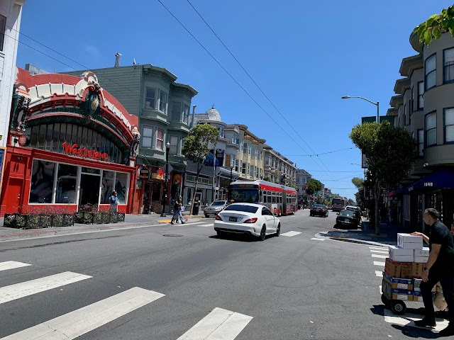
Haight Street, near Ashbury. Unfortunately, the Hippies have long since been gentrified out of this neighborhood.


San Francisco’s “homeless problem” may be overstated by the national media. With the caveat that I did not venture into the Tenderloin, I didn’t see a homeless population in SF any more severe than I might see in Downtown or Midtown Houston. I didn’t have to step over any unhoused person (or their encampments, or their puddles of piss or piles of shit) as I walked along San Francisco’s sidewalks. 

The homeless people that I did see generally kept to themselves and did not accost us for spare change or otherwise make us feel uncomfortable.
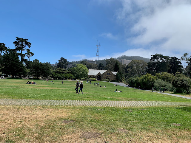
Robin Williams Meadow in Golden Gate Park, with Sharon Art Studio and Sutro Tower in the distance. 


There were, however, signs everywhere around the city warning people not to leave valuables in the their cars. And I noticed that at least one large chain clothing store on Market Street had a line of people waiting to enter; security guards were limiting the number of people who could be in the store at one time, presumably to combat shoplifting.

These were indicators that San Francisco does indeed have a property crime problem that the city is trying to battle. But, as tourists, Corinne and I never felt unsafe anywhere we went.


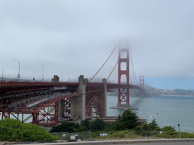
Golden Gate Bridge, as seen from the Visitor's Center on its south end, partially shrouded in fog.


"You just have to see it in person” is a cliché, but in the case of the Golden Gate Bridge, it’s true. I have seen pictures, videos, and movies of the bridge for my entire life, but none of them do it justice. It's hard to appreciate just how big and impressive it is until you've seen it for yourself with your own eyes.  

The bridge, which connects San Francisco with Marin County to the north, opened in 1937.
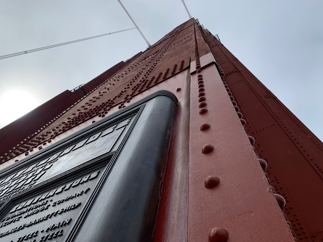
The south tower of Golden Gate Bridge, which rises to a height of 746 feet.


It is possible to bike or walk all the way across the bridge; in fact, we saw people jogging across it. Corinne and I only went as far as the south tower, but we were still treated to a magnificent view of the bay, Alcatraz, and the city. It was cold and windy on the bridge itself, but downtown San Francisco, off in the distance, was bathed in bright sunlight. The city's weather is famously interesting.

The entrance to Fisherman's Wharf. We didn't make it down to Pier 39 to see the sea lions, but we did go to Ghirardelli Square for some chocolate and a beer, so we did a few of the touristy things.


There are so many good seafood restaurants here in Houston. But, respectfully, none of them do crab cakes like they do in Fisherman’s Wharf. Those were surreally delicious. 

In fact, every meal we had in San Francisco, from lunch at a French cafe in Height/Ashbury to dinner at a Thai restaurant in The Castro, was excellent. We weren't in San Francisco long enough to even scratch the surface of all the different cuisines the city has to offer.
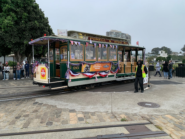
The Powell and Hyde Cable Car turntable near Ghirardelli Square.


We brought the Muni day pass ($5), which allows unlimited rides on buses and light rail for an entire day. This was very convenient for us as we explored the city, although we still did a lot of walking. 

The iconic cable cars are a big tourist draw, and you need a special ticket to ride them (the Muni day pass won't get you on board). We didn't feel like standing in a long line and paying $8 per person just to ride a cable car, but we did have fun watching the cars be manually turned at the end of their route.
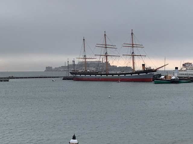
The 1886 rigger Balclutha, with Alcatraz in the background.


As I mentioned previously, San Francisco's weather is famously interesting. During the day, the weather was generally wonderful. Once night fell, however, things got cold rather quickly. "The coldest winter  I ever spent was a summer in San Francisco" may not have been said by Mark Twain, but it's an accurate quote nevertheless.
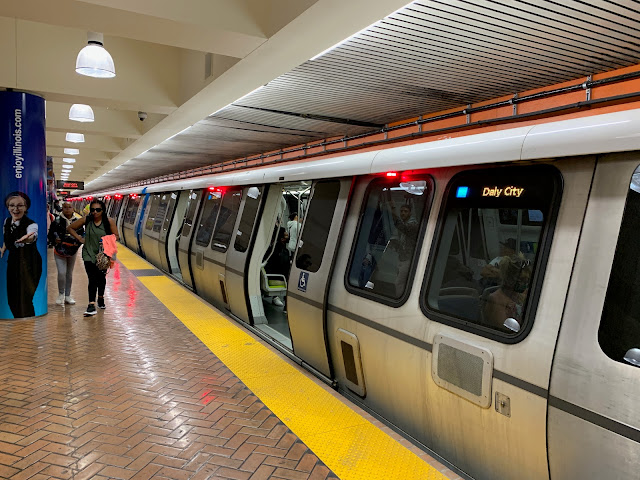
Powell Street BART Station. Along Market Street in downtown San Francisco, MUNI trains run one level below the surface while BART runs two levels below the surface. 


Muni provides transit service in San Francisco itself, while BART (Bay Area Rapid Transit) is a metro system serving the entire Bay Area. Obviously, as a transitgeek I had to take a ride.

As much noterity as the Golden Gate Bridge gets for being an engineering marvel (and it is), the BART Transbay Tube also deserves some recognition. This tunnel, which will celebrate its 50th birthday in just a couple of years, zipped us underneath the Bay from San Francisco to Oakland and back in a matter of minutes. 

Tribune Tower in Downtown Oakland.


The primary purpose of the trip to Oakland was to ride BART; we were in that city just long enough to walk down to Jack London Square and stop in for a drink at a local bar. I was on my best behavior as an Astros fan and refrained from telling A's fans how much their team sucks. 

Jack London Square in downtown Oakland.


The differences in microclimate around the Bay are really amazing. When we took the trip across the bay, it was cold and windy in San Francisco but warm and clear in Oakland. Did I mention that this place has interesting weather?
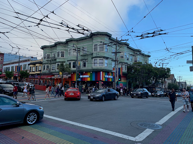
The corner of 18th Street and Castro Street, which is the center of San Francisco's famous "gayborhood." Note the maze of trolleybus catenary wires; the electric motors of Muni's trolleybus fleet handle San Francisco's steep grades better than standard diesel-powered buses. 


Corinne and I have a problem when we travel: we say to ourselves, "let's travel to place X and scratch it off our list of places to see." Then we get there and spend a few days, and realize that there is just so much more to do and see that we have no choice but to return. 

Since we’ve been together, this has been a problem: instead of getting shorter, the travel list keeps getting longer because there are simply so many places we need to return to: Germany, Mexico City, Austria, Venice, Washington DC, Greece, Rome, etc... Now we have to add San Francisco to the list as well. There are entire neighborhoods and attractions - Chinatown, the Embarcadero, the Presidio, Russian Hill, the zoo, Oracle Park, all the museums - that we didn't get a chance to see during our all-too-brief visit.
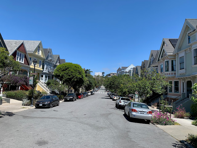
A residential street near Duboce Park.


One final note: Most of what we saw in San Francisco while we walked through it - downtown, Haight/Ashbury, Golden Gate Park, Chrissy Field, Fisherman’s Wharf and the Castro - were normal people doing normal things: hanging out in parks with their kids, fishing off Torpedo Pier, walking their dogs, biking, jogging, having conversations over drinks in outdoor cafes, etc. The city was not a dystopian hellscape.

Does San Francisco have its problems? Yes. Every major city does. However, at a time when this country is horrifically polarized, please do yourself a favor and do not buy into media-driven stereotypes about an entire city.

Monday, January 31, 2022

Why transit agencies still need system maps

Transit consultant Jarrett Walker speaks to the importance of transit system maps:

As transit information tools have gotten better, some transit agencies have stopped offering a system map to the public.  Often, a website offers me trip planning software and route by route timetables, but not a map.  If it’s there, it’s often difficult to find.

I'm noticing this trend within the transit industry as well, and I am not a fan. There's just no substitute for a good system map that people can use to quickly understand and navigate a given agency's public transportation network.

Case in point: last month, as I planned our trip to Birmingham for the bowl game, I was looking for a good way to get from our hotel (near Five Points South) to Protective Stadium. A taxi or an Uber were always options, but I wanted to see if a bus was a viable choice because 1) it's cheaper and 2) I'm a public transportation geek. So I went to the Birmingham Jefferson County Transit Authority's website to do some research. They did have an online trip planner, but in order to use it I had to type in both my hotel's and the stadium's addresses, which I didn't feel like looking up. So I moved on to their bus routes page to look for a map instead. There they had bus routes and schedules individually listed, but no overall system map. Which meant that I would have had to click through all of the routes until I found one that provided the service I needed, if it existed at all.

Walker continues: 

We think system maps are essential.  They’re not just for everyday navigation.  They’re for exploration and understanding.  Some people prefer narrative directions, but many people are spatial navigators, and they need maps.  They’ll understand details only if they can see the big picture.

Another way to think about system maps is that they show you where they could go, and how.  They give you a sense of possibility.  (It’s the informational dimension of access to opportunity.)  Maps also show visually how different services work together.  Finally, good system maps help people make better decisions about where to locate, or even where to build things.

To their credit, the BJCTA has published GTFS data for their bus network that applications like their own trip planner or Google Maps use to suggest directions. I ended up finding our hotel on Google Maps, and used that to determine that there was indeed a route that ran between our hotel and the stadium. I then went back to the BJCTA website to get its route and schedule information. It was convoluted, but it worked; we used the Magic City Connector bus to get to and from the bowl game without a problem. 

That said: while trip planning apps and GTFS feeds are definitely helpful in navigating a bus system, those should not serve as replacements for a well-designed transit map showing routes, stops, and major landmarks. Such a map would have allowed me to identify the bus route I wanted to use almost instantly, without having to click through individual route schedules or use a clunky trip planning app, or cross-reference using Google Maps. 

Given that Birmingham's bus network isn't particularly large, it shouldn't be difficult to design a good system map and place a link to it on the BJCTA web page. I'm sure I'm not the only one who would find it beneficial. Walker concludes:

But if a system map doesn’t exist, people can’t understand all that your transit system can do.

Exactly.

Examples of good (and bad) transit system maps can be found on transitmap.net.

Wednesday, December 08, 2021

The bus driver shortage crisis

Given my profession, I have been well aware of the operator labor problems public transportation agencies are currently facing. Transit consultant Jarrett Walker believes it's a genuine emergency:

I know we’re having a lot of emergencies and it’s hard to keep track, but many US transit agencies are looking at devastating service cuts due to a shortage of bus drivers.  Drivers are quitting or retiring early much faster than agencies can replace them.  One friend told me their agency is losing 10 drivers for every one they hire.

Here in Portland, TriMet is cutting 9% of its service, bigger even than the cuts in the Great Recession.  I’m seeing similar cuts all over the US.

Can you blame the bus drivers?  The job was always hard, and now it’s more dangerous in two ways: People breathe on drivers a lot, not always masked, and the mental health epidemic is showing up in more rudeness and bad behavior.  Worst of all, some US cities are seeing a rise in assaults on drivers.

Meanwhile, there’s been huge growth in delivery jobs, some of which pay decently and don’t involve dealing with people.

I'm seeing this problem locally as well. Local agencies like METRO are struggling to keep their heads above water because they're having trouble finding drivers; as a public agency, it's simply hard for them to compete against the wages and benefits that private delivery companies like Amazon and UPS are currently offering. This means that METRO is unable to add back the service that they had to cut at the beginning of the pandemic as much as they would like. This in turn effects everyone who uses transit - whether it be suburban workers who are beginning to return to the office or "essential" workers who, even during the height of the pandemic, relied on public transportation to get around - because buses come less frequently, are overcrowded, or don't operate at times of day (i.e. late evenings) when people need them. 

Transit faces an uncertain future as it is, with people still wary of being in close quarters on buses and trains and more people working from home. But it's still a critical part of our urban infrastructure that needs to be adequately staffed in order to be effective (and no, driverless buses are not "coming to the rescue" anytime soon). 

Walker has a couple of suggestions for transit riders and concerned citizens alike:

What can you do?  Advocate for funding, but also:

  • Be kind to your bus driver. If you have a moment, watch them in action.  Notice how hard their job is, and how much they have to deal with.  Thank them.
  • Be kind to your transit agency management.  It’s a terrible moment for them.  They’re as horrified as you are by having to cut service.  (You can be kind to them and still be mad at them for some things. But be sure that what you’re mad about is really their fault.  The driver shortage isn’t.)

This advice may sound simplistic, but it’s actually practical.  Kindness is a powerful form of activism.  A lot of it can add up to big change.

Friday, March 26, 2021

Is rush hour over?

This NBC News segment from last week is notable for two reasons: first, it features Craig Raborn, the Houston-Galveston Area Council's* new Director of Transportation. Craig takes over as the Director of the local Metropolitan Planning Organization from Alan Clark, who retired last fall after serving as Director for 37 years.

Second, this segment alludes to one "great unknown" of life after the COVID-19 pandemic. Coronavirus has had an obvious effect on traffic, especially during rush hour commutes; but as it ends, and as people resume "normal" activities, will "rush hour" return? Or will people continue to work remotely, rendering rush hour as we know it obsolete?


If the pandemic has proven anything, it is that mass telework is possible, and businesses may choose to continue doing it even after the pandemic is over. That would suggest that there may be less rush hour traffic in the future.

On the other hand: after 13 months of working remotely, people might also be ready to get back into the office, to meet with their co-workers face-to-face, to not endure endless awkward Zoom and Teams meetings. If that's the case, then rush hour in late 2021 could be just as bad as it was in 2019. In fact, it could even be worse, if people decide that - even after the pandemic is over - they're not comfortable using carpools, vanpools, public transportation (or any other conveyance where they're in close proximity to other people) to get to work.

Nobody knows for sure what commuting patterns will look like once the pandemic ends. Hopefully we'll know the answer sooner rather than later. 

In the meantime, please get your vaccine once it becomes available to you.

*full disclosure: I am an employee of H-GAC and Craig is my boss's boss's boss.

Saturday, June 27, 2020

Pandemic Link Dump

Passing along a handful of random articles and topics I've come across over the last month or so...

Urban freeways are a product of racial injustice, and its effects are still being felt here in Houston.  I've touched on this before, and in the wake of the protests for racial justice sparked by the murder of George Floyd, it's become a topic once again. Urban freeways were largely built through minority neighborhoods, dividing and displacing their inhabitants. Decades later, those scars remain:
Thousands of peaceful protesters in the Twin Cities occupied Interstate 94 over the weekend as they marched from the Minnesota State Capitol in St. Paul to Minneapolis. 
For the region’s African-American community, which has been leading the ongoing protests over the fatal arrest of George Floyd and the use of police force on black Americans, the concrete they were standing on bears significant meaning. 
It was this highway that, in the 1950s and ‘60s, tore apart the once-thriving neighborhood of Rondo — the heart of St. Paul’s largest African-American community — and helped spur decades of racial segregation in the region. 
Minnesota Governor Tim Walz acknowledged as much during a Saturday press conference. "It wasn’t just physical — it ripped a culture, it ripped who we were. It was an indiscriminate act that said this community doesn’t matter, it’s invisible,” he said. “This convenient place to put a highway so we can cross over this place and go from the city out to the suburbs.”
The once and future effects of these freeways remain a topic of controversy today, even here in Houston as TxDOT continues forward in it plan to reconstruct IH-45 north:
Members of the Houston-Galveston Area Council’s transportation advisory committee this week voted to keep portions of the I-45 project in the area’s short-term transportation plan, but with a host of caveats. Chief among those conditions is that the Texas Department of Transportation respond in detail to a set of requests from Houston planners outlining exactly what they can and cannot do to stay within the freeway’s existing boundary and agree in writing to protect displaced residents and businesses. 
The lack of clear commitments worries skeptics, who fear neighborhoods affected by the massive redesign from downtown north to Beltway 8, such as Northside, Independence Heights and Fifth Ward, will continue to bear the brunt of TxDOT and Houston’s highway expansion. For decades, neighborhoods along I-45, I-69 and I-10 north and east of downtown have felt the effects of living within shouting distance of the freeways, as mostly white officials routed the thoroughfares through black and Hispanic communities. 
“A vote on this project that continues those very systems of oppression, disparity and racial inequities without addressing the real problems is only supporting and continuing that system of racism,” said Oni Blair, a member of the transportation advisory committee and executive director of LINK Houston, an advocacy group that has organized opposition to the I-45 plan.
The IH-45 north rebuild provides an opportunity to improve the freeway while at the same time address the impacts that the freeway has historically had on adjacent communities. TxDOT needs to listen carefully, and not repeat the mistakes of the past:
“To leave I-45 as it is currently configured would be a mistake,” said Carol Lewis, director of Texas Southern University’s Center of Transportation Training and Research. 
Ignoring the issue of social justice would be, too, she said. TxDOT has gone to historic lengths to solicit comment but must now reconcile those concerns with its plans and the engineering analysis of how the new freeway and changes to it will affect how people and freight move. 
What is clear, Lewis said, is that TxDOT cannot brush aside how the freeways got where they are now. 
“I think historically TxDOT has been 100 percent guilty of being 100 percent insensitive,” Lewis said, noting what is now I-69 along the east side of downtown gutted Fifth Ward.
How do we get people back on the bus? I wrote a couple of months ago about the essential role of public transportation during the Coronavirus crisis. Now, as local economies reopen, transit agencies need to convince "non-essential" commuters that it is safe to start using transit again:
Masks are mandatory on subways and buses in Washington. San Francisco is betting longer trains will help riders social distance. Crews disinfect New York’s trains daily -- stations twice a day -- and are testing ultraviolet light devices to see if they kill Covid-19 on surfaces. 
As states gradually reopen, transit agencies are taking steps to coax back passengers who’ve been told for months to avoid just such tight quarters with strangers -- an effort that will ultimately influence the economic recovery. 
“For certain businesses teleworking isn’t really an option, so we still need to figure out ways to get those people to work,” said Ed Mortimer, vice president of transportation and infrastructure at the U.S. Chamber of Commerce. 
Especially in urban areas, where many people don’t own cars, mass transit will be crucial to reviving economies. But enticing passengers back on board may require adding trains and buses so people can space themselves further apart -- adding stress to agencies already reeling from declining ridership and rising cleaning costs.
Public transportation might not be the disease vector it's feared to be, but it's understandable that people are going to be wary of crowding on board buses and trains with other strangers. Transit agencies are poised for a slow and difficult recovery, especially since people are likely to commute differently in a post-COVID world, and they probably need to re-think the way they provide service and define success both during and after the pandemic. That being said, our cities will not experience full economic recovery unless their transit networks also recover.

Could Houston become a climate policy leader? Maybe:
April was supposed to be a big month for Houston city planning. America’s largest unzoned city was poised to host the American Planning Association’s national convention for the first time, bringing thousands of attendees to town. Walking tours were arranged; awkward cocktail mixers were scheduled. 
Of course, with a global outbreak of the coronavirus, it wasn’t meant to be.
I cannot begin to express how much I was looking forward to the APA's National Planning Conference being here in Houston, as I had never attended this event before. Likewise, I cannot begin to express how bummed I was when it was canceled in the midst of the Coronavirus pandemic. I hope the APA makes plans to return to Houston with this is all over.
Undeterred, Houston quietly adopted the Bayou City’s first citywide climate action plan on the 50th anniversary of Earth Day. If city leaders can pull it off, America’s sprawling oil capital could end up teaching a lot to more traditionally green urban strongholds.
The city's climate action plan is intended to be a blueprint to Houston reducing its impact on the environment. Given the city's characteristics - the refineries, the sprawl - that's going to be a challenge, so the plan includes both standard and innovative elements.
The plan includes plenty of mainstay climate-policy prescriptions, including calls to electrify the city’s fleet of vehicles, switch to renewable sources of energy, and improve energy efficiency in buildings. But then things become rather unique. The city’s first bicycle master plan, adopted in 2017, gets a lot of play, as does the MetroNEXT Moving Forward plan, a widely lauded $3.5 billion push to overhaul mass transit in the notoriously auto-oriented city. The emphasis on mobility makes sense, since nearly one-third of U.S. greenhouse gas emissions come from transportation, and Houston maintains one of the highest rates of automobile use in the country. 
Toward this same end, one of the plan’s more innovative proposals calls on policymakers to eliminate minimum parking requirements by 2030. While Houston famously lacks zoning — meaning that it doesn’t segregate uses or restrict densities — it still enforces some conventional land-use regulations. These include minimum parking requirements, which mandate that developers build off-street parking for each project, regardless of actual demand. In Houston, this can mean up to two parking spaces for every apartment or four spaces for every thousand square feet of office space.
Houston's lack of zoning, furthermore, might make it easier for the city to redevelop in a sustainable manner, featuring more walkable, mixed-use, higher-density development, than other cities that are incumbered by an onerous development process that is subject to NIMBY interference.
The city has a long way to go before it becomes anyone’s idea of an environmental exemplar. But if all goes according to plan, Houston could soon rank among those cities that have scrapped out-of-date parking requirements — a group that conspicuously doesn’t include progressive stalwarts like Portland and New York City. In a city otherwise famous for its supposed lack of planning, easing up on the right rules might just turn Houston green.
Stay tuned.

"The right thing - just at the wrong time." Take a few minutes to read this excellent XFL postmortem by ESPN's Kevin Seifert. The article takes a look at why the well-funded league suddenly folded (it might not have been completely due to Coronavirus), it's prospects for revival, and the potential for spring football generally:
"We still don't know that spring football works in this country," said Andrew Kline, founder of the investment bank Park Lane, which specializes in sports investments. "Football season is so intense, and it's just associated with the fall season. You wonder if part of the cycle is that people need to come down from it for a while."
I'm obviously a fan of spring football, but its track record is dismal, and as even as the XFL winds its way through bankruptcy proceedings, I'm skeptical that we'll ever see another Houston Roughnecks game again. At any rate, it appears that we could have to go for awhile without any football at all. Which will make my fall miserable, to say the least.

The removal of Confederate statues and monuments should not be a "liberal" endeavor. I can't believe I'm actually linking to Rich Lowry in the National Review, but in this case he's right:
Conservatives […] reflexively oppose politically correct campaigns to destroy anything giving offense. 
They fear where the slippery slope of woke iconoclasm will lead — first it’s Jefferson Davis, ultimately George Washington. 
They value tradition and worry we are trashing part of our history.This impulse, though, is a mistake. Confederate statues and symbols deserve to be reevaluated, and often mothballed. 
The statues are an unnecessary affront to black citizens, who shouldn’t have to see defenders of chattel slavery put on a pedestal, literally. 
It is impossible to evaluate these monuments without considering the context of why they were created. Many of them were erected as part of the push to enshrine a dishonest, prettied-up version of the Confederacy.
Lowry ends by noting that "secession was a traitorous act that threatened to destroy the American nation, to create a rump republic built on slavery, and to make impossible the subsequent rise of the United States to a world power." Liberals and conservatives alike should understand the fact that the Confederate States of America was, quite simply, a racist and treasonous enterprise that was defeated over a century and a half ago.

I occasionally come across the argument that the removal of Confederate statues and monuments is somehow "erasing history." This is bullshit. There are no monuments to Hitler or Rommel or Göring in Germany, but we still know that county's history - a history the German people of today most certainly do not want commemorate.

These statues and monuments belong in museums, battlefields, and military cemeteries. They do not belong in our parks, our squares or our capitol grounds.

Last but not least, congratulations to Liverpool.

Tuesday, April 14, 2020

The essential service of public transit

Right now, the nation's public transportation providers are under a lot of stress. As the coronavirus pandemic grinds life to a halt and forces people to stay at home, ridership has plummeted and the funding sources that sustain them - sales tax and farebox revenue - have dried up. At the same time, agencies are assuming unbudgeted expenses to take precautionary measures such as deep-cleaning and disinfecting vehicles, creating physical separations to ensure social distancing between passengers on buses and trains, and providing protective equipment - masks, gloves, googles - to bus and train operators.

Why would transit agencies even make these considerable expenditures at a time when they're carrying so few passengers? With everything else in our society and economy shut down right now, why don't transit providers just do the same in order to conserve resources?

Transit consultant Jarrett Walker explains why that isn't possible:
Why are agencies behaving this way? Because they are not businesses. And if there’s one thing we must learn from this moment, it’s that we have to stop talking about transit as though ridership is its only purpose, and its primary measure of success. 
Right now, essential services have to keep going. It's not just the hospital, the grocery store, and basic utilities.  It’s the entire supply chain that keeps those places stocked, running, and secure. Almost all of these jobs are low-wage. The people using transit now are working in hospitals that are saving lives. They are creating, shipping and selling urgently needed supplies. They are keeping grocery stores functioning, so we can eat. 
In transit conversations we often talk about meeting the needs of people who depend on transit. This makes transit sound like something we’re doing for them. But in fact, those people are providing services that we all depend on, so by serving those lower income riders, we’re all serving ourselves. 
The goal of transit, right now, is neither competing for riders nor providing a social service for those in need. It is helping prevent the collapse of civilization. 
What’s more, transit has always been doing that. Those “essential service” workers, who are overwhelmingly low-income, have always been there, moving around quietly in our transit systems, keeping our cities functioning. Too often, we have patronized them by calling them needy or dependent when in fact everything would collapse if they couldn’t get to work.
Interestingly, the theme of today’s Google’s “Doodle of the Day” was dedicated to public transportation workers. They are at the front line of the battle against Coronavirus, providing the essential service of getting other essential workers to hospitals, grocery stores, pharmacies, warehouses, and other essential businesses. They are also dying as they provide this essential service.

As I've said before: public transportation, as its name implies, is a public good, like police and fire protection, parks, and libraries. While we ideally want its services to be used as much as possible, its primary purpose (contrary to what its libertarian critics might claim) is not to continually increase ridership or maximize farebox recovery. Its purpose is to provide mobility to the people who need it, including (and especially) in times of crisis.

"In big cities, transit is an essential service, like police and water, without which nothing else is possible, Walker concludes. "Maybe that’s how we should measure its results."

Sunday, January 19, 2020

Deadbeat student discovers that actions have consequences

I didn't even know "parking barnacles" were a thing until I saw this story:
A University of Houston student’s tweet expressing frustration about the hefty price to remove a clamp the school placed on her car’s windshield has gone viral. 
The tweet, posted Wednesday by a student identifying herself as babayaga, Friday had received more than 2,800 retweets, 12,000 likes and 1,300 comments, both supportive and critical. 
“$920 to get this removed,” the student tweeted with a sad face emoji. “All bc the university doesn’t have enough permits available nor parking options that are affordable for students that already pay to attend the University. Everyone send a dollar my way.”
Look, I get it: parking has been an issue at the University of Houston ever since I was a student there almost three decades ago. The university has tried to increase parking capacity by building garages. They've also increased student housing options in order to encourage more kids to live on campus and avoid the parking problem altogether. But at a school that by its nature has a large commuter student population, finding a place to put your car while you go to class remains an issue.

That being said, my sympathy for this student evaporated when I read further:
UH spokesman Chris Stipes and Neil Hart, head of the university’s parking and transportation services, emphasized that barnacles — the bright yellow, plastic immobilization devices that suction to vehicle windshields with up to 1,000 pounds of force and block the view of the driver — are only used on the cars of habitual offenders of parking protocols.
"Habitual offenders" being the key phrase there.
UH’s barnacle devices, implemented in early December 2019 as a way to deter parking violators and simplify fining processes, are only used for cars consistently parked on campus without a permit and with five or more existing citations, according to the spokesmen. To date, 37 cars have been barnacled, with the violators receiving an average of nine citations for parking without a permit. 
“When somebody is parking illegally and doesn’t have a permit, they’re taking a space from someone else who has paid,” Stipes said. “This is a deterrent against that. We don’t have free parking on campus.” 
In the past, the university would tow the vehicle, a process that costs more time and money.
So in other words, this person did not possess a valid parking permit, parked on campus illegally multiple times, finally had this "barnacle" contraption attached to her windshield, and is now upset with the school and is asking strangers for money to remove the device. Entitled much?

When you park your car on campus without a permit, you are essentially committing theft because you are taking a space away from somebody who has purchased a valid permit. And while parking permits might not be cheap, there are other options for getting to class if you have trouble affording one. You can park remotely, you can carpool with a student, and you can even (gasp!) use public transportation, which is available to UH students at a discount.

You're in college now. You can solve this problem without being a deadbeat, and without resorting to whining and begging for social media to help you fix the problem you caused.

Fare-free public transportation is still a bad idea

If public transportation is, as its name implies, a public good, and if farebox revenues typically cover only a small amount of a typical transit agency's operating costs, then why not just make public transportation free for everyone to use? More people might be encouraged to get out of their cars and use transit if it were free, and the economic barrier to low-income people who need it the most would be eliminated.

It's a well-intentioned idea that has been around for as long as public transportation has existed, and transit agencies around the country give it a try from time to time. Kansas City, Missouri is the latest city to experiment with fare-free public transit, and there was a suggestion to make public transportation free here in Houston as well. However, that does not appear likely to happen:
After a comprehensive analysis by Metropolitan Transit Authority staff, transit board members said removing fares from the system actually would increase agency costs by creating a need for more buses and operators, potentially to the tune of $170.6 million annually.

"It is just not feasible to do free fares," Metro board member Jim Robinson said, echoing others on the board and in the transit agency.

Proponents argue transit use would skyrocket and reduce overall traffic volumes if transit was free. Riding also would be easier, they say, because buses and trains could open front and rear doors for boarding without the need for users to stop and pay fares. 
Metro's analysis concluded that ridership would jump from 86 million trips a year to an estimated 117 million if fares were eliminated altogether. Even offering free rides only during peak hours could boost ridership to around 100 million, the study found. 
Those new riders, however, would come at a big cost, said Julie Fernandez, the transit agency's lead management analyst. To handle the demand, Metro would need nearly 500 more vehicles, mostly buses, and 415 new operators. Such a sizable jump in vehicles and employees would require the agency to build a new bus operating facility to complement the existing six bus depots. 
Even preparing the transit system for free rides would take four years, Fernandez said, adding, "it takes time to order new buses." 
The cost of going free prompted many Metro board officials to conclude it was not likely.
It's possible that, as they considered the effects of fareless transit service, METRO staff took a look at lessons learned from another Texas transit agency that experimented with free fares: Capital Metro in Austin in 1989 and 1990. That experiment did not go well, a former Cap Metro dispatcher explains, because it created a host of problems that were costly to solve. "[B]y the time it was over our customers, operators, union, public, police and transit staff were begging for it to end," he says:
Guess what? With free fare, you will need more bus operators. Yes, even with existing capacity on your buses you will need more staff. This is because your newly gained riders won’t conveniently fill the buses during off-peak times when seats are available. They’ll crowd out your regular commuters and local passengers during the afternoon peak. Your system will be overwhelmed during the weekday afternoon peak because this is when everyone likes to ride.
Cap Metro didn't just have to find new bus operators, either; they also needed more security:
Security services will have to be expanded because incidents will increase. Operator staffing requirements will increase exactly at the time attrition increases. Field Supervisory requirements will increase as problems multiply. Why? More people, more problems. More medical emergencies (seizures and falls), more theft, more sex crimes, more lost children and elderly, more drunks, more fights, more operator assaults, more service interruptions. You’ll have to increase street presence of supervisory personnel, which come from the bus operator ranks, increasing attrition even more. You may want to reorg to put superintendent-level personnel in the field to supervise the supervisors. Oh, and you may have to hire more staff in the customer service (complaints) department as your system reliability rapidly declines and complaints skyrocket.
Reliability is a critical aspect of transit service:
Reliability will take a huge hit. Just because your system is free does not mean customers will forgive poor service. Making a bus system wonderful does not mean making it free. Customers want reliability and safety and are willing to pay for it. 
As ridership grows the number of passengers at the bus stop increases. This increases dwell time at the bus stop. Already it is taking longer to get to your destination. This compounds over the length of the route. The longer and busier the route, the greater the impact. This is extremely difficult to schedule properly as morning and afternoon travel times will vary greatly. Anticipating free fare ridership growth and service impact six months in advance is challenging. In the meantime, on-time performance will decline precipitously. As the bus drags down it affects the next assignment for the operator. All these negative effects focus pressure on the afternoon peak. Everything gets later until we reach the highest peak travel time of the day. Trips will be lost as operators try to get to the terminal with full buses. Stops are bypassed in the final quarter of the route as capacity is reached. Some passengers are bypassed by two buses. Adjusting schedules lengthens service hours, conflicting with union work rules and maximum drive times, ultimately requiring more operators.
The end result for Austin was that fare-free public transportation ended up hurting the very riders it was supposed to help: it made buses overcrowded, less safe, and less reliable. While this isn't to say the same thing would happen in Houston, given enough time to plan and prepare, or that it will happen in Kansas City (which carries only a fraction of riders as Houston's network), it is a cautionary tale about the unintended consequences of good intentions.

All that aside, my misgivings about fareless public transit remain the same today as they were when I wrote about it a decade ago: it reduces revenues which in turn could lead to service cuts, it allows buses and trains to become rolling hangouts for people who aren't actually "going anywhere," and it deprives the system's actual users of any sense of stakeholdership:
Even if it is mostly subsidized through tax revenues, the fact that a fare is being collected gives transit's actual users a special sense of ownership of the system because they pay for the service twice: once through taxes and again through fares. That, in turn, empowers them to hold the agency accountable for things like shelters that are clean or buses that run on time. Eliminate fares and the user becomes no more of an "owner" of the system than the public at large. This reduces or eliminates entirely the rider's sense of empowerment and leads to a lack of respect for riders' needs. Service quality degrades, and people are discouraged from using the system.
There are good discussions to be had about targeted fare reductions (e.g. for students, or during ozone action days), or about how much of an agency's operating revenues should be covered through the farebox (METRO's $1.25 one-way base fare hasn't been increased in years, despite inflation). But eliminating all fares on a large public transportation network such as METRO's would likely create more problems than it solved and hurt the people who depend on it the most to get around. 

It will be interesting to see how things work out for Kansas City.

Kuff, who has been similarly skeptical, has covered this discussion here, here and here.

Thursday, November 21, 2019

Starchitects, high-rises and Quito

I recently wrote about the potentially transformative effect of a new subway in Quito, Ecuador. One of the subway's intended effects is to create density by encouraging more high-rise construction around stations. Architectural Digest explains how some of the world's top architects are participating in that transformation: "Initiated by an enterprising local developer and fueled by a revised zoning code and new transit-oriented development incentives, Quito is shaping up to be a starchitect’s next frontier."
The urban shift in Quito started with a relocation. In February 2013, the municipal government moved the entirety of Quito’s 1960 Mariscal Sucre International Airport from the dense residential and commercial neighborhood that had grown around it to an agricultural area 12 miles away. The previous location of the airport (now being transformed into a large park) had capped surrounding building heights at four stories. A revised zoning code now allows towers in the city up to 40 stories, though air rights must be purchased from the government.
As fun as it was to watch the planes fly overhead on their final approach to the old airport - I used to sit at the window and watch the 747s of Lufthansa and KLM, the DC-10s of Iberia, the colorful 707s of Ecuatoriana and even the droning Lockheed Electra turboprops of TAME - the flight path was rather treacherous, given the city's geography. It was also rather loud. Quito's new airport is larger, with a longer runway and a flight path the does not require you to land in the middle of a city crammed up against a volcano.
Recognizing the new potential to build taller and better, Quito-based development company Uribe & Schwarzkopf has been recruiting world famous architects with a "why not here?" attitude. For the 46-year-old, two-generation company where father Tommy Schwarzkopf and son Joseph Schwarzkopf work side by side, it became increasingly obvious that sometimes you can't do it all. For about the last 40 years, the firm had taken a design-build approach, with Tommy (a trained architect) at the helm of designing modular residential and commercial towers across the capital. The buildings are efficient, but far from radical, on a growing skyline. When Joseph came into the family company, the two hypothesized that starchitects could bring more intrigue to their projects, and Tommy says he was satisfied to hand over the design reins and accept a new development challenge. 
Thus, their firm’s first foreigner-designed tower sprung up in González Suárez, an artsy, bohemian, and increasingly affluent neighborhood on a slope. The developers called on Miami-based Arquitectonica to design the 22-story residential Yoo Quito. French designer Philippe Starck crafted the interiors and amenities, which are dotted with his furniture and inspired by the clouds the tower seems to touch. Floating above the roof terrace is a cloudlike shape of undulating aluminum panels that hides the building’s necessary mechanical systems. On the ground level, too, the tower does something new for Quito: Retail at the base engages the public with the building in a city where most private residences have a barrier to entry.
I know exactly where Yoo Quito is - on Avenida Gonzalez Suarez, between Avenida Francisco de Orellana and Calle Muros - because it is directly across the street from the small apart-hotel on Calle Muros where my family and I lived in the late 1980s when we spent our summers in Ecuador. That part of town always had high-rises, both along Gonzalez Suarez as well as Avenida 12 de Octubre. Now, if local officials have their way, the rest of the city will start going vertical as well.
The government is, however, working to increase city center density through the city's first underground metro line, whose first phase will run from north of the former airport to the southern suburbs in 2020. Explains Jacobo Herdoiza, a former secretary of territory for Quito, the hope is that upper-class residents who currently drive from the suburbs to work downtown each morning will ditch their cars for mass transit and move back to the city center. For developers, an incentive has been set in place: If you construct a new residential project within an eight-minute walk from the new metro or a five-minute walk from a bus rapid transit station, the city will pick up the tab for your air rights.
The article claims that "Quito suffers from a pedestrian-unfriendly urban streetscape." I'm not sure I would completely agree - some parts of Quito, such as the colonial center or the Mariscal Sucre district, offer a good, active pedestrian environment - but the city is otherwise mostly automobile-oriented and I recall that many Quito sidewalks were narrow, uneven or poorly-maintained, with cars in driveways blocking them, a lack of curb cuts and other accessible infrastructure, and blank, uncomfortable security walls adjacent to them. Good pedestrian infrastructure is critical to the success of transit, and this is where transit-oriented development comes in to play.
These transit-oriented development incentives convinced Uribe & Schwarzkopf to hire one of the world's most buzzy architects, Bjarke Ingels of BIG, to design two residential towers (the firm's first projects in Latin America) along the forthcoming metro line. Across from La Carolina Park, the city's most popular green space, the 32-story IQON and the 24-story EPIQ towers by the architect are quickly rising. The former is set to be the city's tallest building and has a facade that, when trees are planted on each terrace, will reflect the adjacent park. The latter takes a more historic approach to its materials: It will be constructed of concrete dyed in various shades of pink to reflect Quito's terra-cotta heritage. Green roofs atop each setback become communal terraces for residents, while the ground level is activated with retail, offices, and a restaurant, a strategy that is hoped to encourage pedestrian traffic.
To be sure, these signature starchitect luxury high-rises are only part of the transformation process. Ecuador is still a low-income country and the percentage of the population that can afford to live in them is low. In order for the process to truly work and for Quito to reach its potential as a vibrant, walkable city, a lot of less-iconic but more-affordable housing options will need to be constructed as well. But by giving famous architects a "canvas" for their designs, perhaps an impetus can be created in Quito's development community for dense, mixed-use and pedestrian-friendly construction for all income levels. As the developer Tommy Schwarzkopf explains: “A new skyline for the city is being created and a new type of citizen is emerging.”

Did I mention that it's time for me to go back to Quito?

Wednesday, November 13, 2019

What a difference sixteen years makes

In November of 2003, the Metropolitan Transit Authority of Harris County held a referendum seeking bonding authority to implement its METRO Solutions transit plan. The plan, which envisioned a significant expansion of its (at that time still unopened) light rail system, was extremely controversial.

It garnered significant, well-funded opposition, and narrowly passed: 51.7% in favor to 48.3% opposed. The geographic disparity of the vote - urban, largely-minority precinct were generally in favor, while suburban, largely-white precincts were opposed - was stark.

The amount of bonding authority being requested was $640 million ($891 million in 2019 dollars).

In November of 2019, METRO held a referendum seeking bonding authority to implement its METRONext transit plan. The plan, which was focused on bus-based improvements but still contained a light rail expansion element, was relatively uncontroversial. It attracted only token, underfunded opposition, and was overwhelmingly supported by voters.

Factoring in the results from Harris County as well as the bits of the METRO service area that are in Fort Bend, Waller and Montgomery Counties, last week's METRONext referendum passed by a margin of 68.2% to 31.8% - a split of just over 2 to 1. Geographically, the plan was supported in precincts representing all ethnicities and income levels, and opposition to the referendum was limited to a handful of suburban and rural areas.

The amount of bonding authority being requested in last Tuesday's vote was $3.5 billion.

Certainly, some of the difference in the level of support between the two plans may have to do with the contents of the plans themselves. The 2003 plan was centered on light rail expansion, which is by nature expensive and controversial, whereas the plan approved last week is more focused on bus rapid transit (which works well when done right but which is currently unproven in the region) as a high-capacity transit technology.

That said, I think the greater reason in the difference in support between the two plans is simple demographics. Houston, Harris County and the surrounding region have grown and changed significantly over the last sixteen years, and local voters are more supportive of public transportation today than they were in 2003.

Traffic congestion is currently the number one concern of area residents, and highway widening projects that were once routine are now generating significant opposition. Local voters are looking for other ways to get around.

Jeff Balke has more.